Four Peaks Wilderness

Four Peaks Wilderness
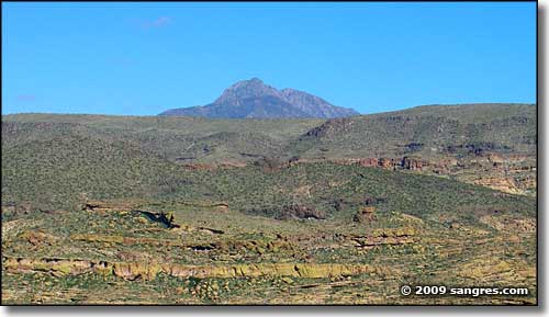
The 61,074 acres of the Four Peaks Wilderness are centered around a major mountain complex with four distinct peaks. This is the southern Mazatzal Mountains, a dry, steep and rugged range that stretches north-south across eastern Arizona for many miles. The highest of these peaks is Brown's Peak (7,657'), and the land drops from here down a series of complex ridges and drainages to deep gorges and bluffs to a low point of about 1,900'. The highlands are covered with Ponderosa pines and some Douglas firs. There's even a few aspen on the north side of Brown's Peak. Below that you'll find dense thickets of pinon, manzanita and Gambel oak. Below that the grasslands blend into the ocotillo, cholla, saguaro and paloverde growth of typical Sonoran Desert countryside. Canyons that hold water flows often are shaded with sycamores and cottonwoods.
The bulk rock of the uplands in Four Peaks Wilderness is made up of Precambrian granites and schists, although the sheer rock faces of the peaks themselves are a cap of Precambrian quartzite and shale. This rock is all clearly exposed in Cottonwood and Boulder Canyons and along Buckhorn Ridge. South of the main peaks themselves (and rising above Apache Reservoir) you'll find the Painted Cliffs: a zone of layered ash flows and volcanic tuffs deposited during the Cenozoic age. That makes the time difference between deposition of the volcanic materials and the solidifying of the underlying igneous/metamorphic rock between 2 and 3 billion years...
As hard as it is to get around in this broken and incised countryside, back in the mining days there were several roads cut into these mountains. Some of them are still in use as hiking trails. A large fire in 1996 burned off a large portion of this property and formerly treed areas still haven't recovered. This area is pretty dense with the black bears but you'll also find skunks, ring-tailed cats, deer, javelinas, mountain lions and coyotes. You'll also want to look out for centipedes, millipedes, black widow spiders, scorpions and rattlesnakes.
Most of the 40-mile trail network in Four Peaks Wilderness is in terrible shape, partly because only a few trails actually see any use. The busiest trails (and therefore the best maintained) are probably the Four Peaks Trail, the Brown's Peak Trail and the Pigeon Trail. Most of the signage has either been damaged, destroyed or classed as "collector's items" (and consequently been "collected"). Water is often impossible to find because most of the springs and streams are barely even seasonal, although the July and August monsoons can often cause flash flooding. As this is a climatic "island in the sky" zone, winter can often bring snows above 6,000'. And summer often sees temperatures 15°F cooler at the top than at the bottom of the hill. But once you get up on the hill a bit, you've got a great view down on either Roosevelt Lake or Apache Reservoir...
Group size is limited to 15 head of people and 15 head of livestock. The stay limit is 14 days in any 30-day period.
Legend has it that Jacob Waltz (Arizona's famous "Lost Dutchman") traveled through the Four Peaks Wilderness area to shake off any would-be followers who might be seeking his legendary gold mine in the Superstition Mountains.

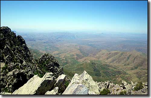
The view west (toward Phoenix) from the summit of Brown's Peak

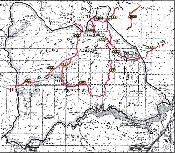
Four Peaks Wilderness trail map

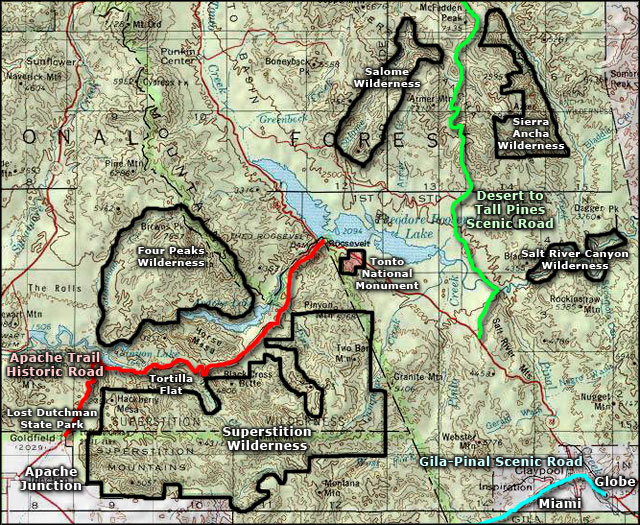
Four Peaks Wilderness area map
