Powderhorn Wilderness

Powderhorn Wilderness

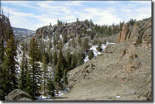
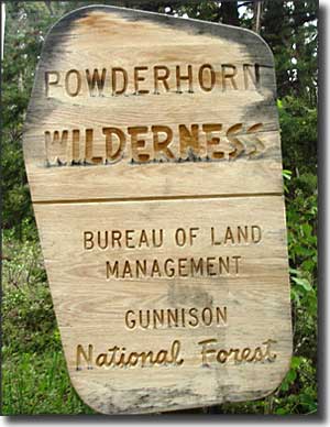
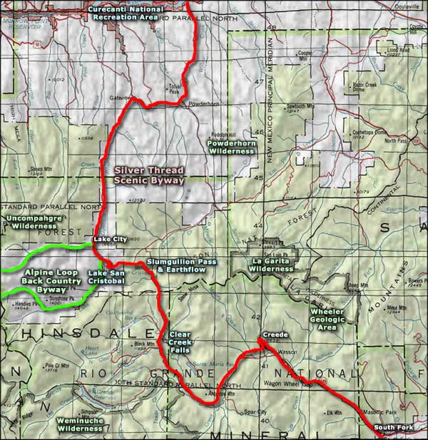
Powderhorn Wilderness is located about 10 miles northeast of Lake City and occupies some 62,250 acres. The wilderness is approximately 23% National Forest and 77% BLM. Elevations vary from 8,699' in the north to 12,600' in the south. A significant portion of the upper plateaus is above 12,000'.
This is the northern edge of the San Juan Mountains, where the mountains fade down into the sagebrush meadows and fish-filled lakes of the Gunnison Basin. The Cannibal and Calf Creek Plateaus are among the largest expanses of flat and undisturbed alpine tundra in the lower 48 states. With the lack of tree cover on the upper plateaus, the views reach as far as the San Juan, Sawatch and Elk Mountains.
The western and northern slopes of Powderhorn Wilderness are significantly steeper than the southern and eastern slopes. The upper plateau is also relatively flat with wide, shallow valleys and a lot of running water. The stands of fir, spruce, aspen, and pine that blanket the lower reaches of this countryside are roamed by small herds of mule deer and large herds of elk in the warmer seasons and the trout fishing at Devil's and Powderhorn Lakes is excellent. You'll also find mountain lion, bobcat, beaver, coyote and smaller mammals. Every now and then a moose from the Spring Creek Pass herd will wander into the riparian areas.
The Cannibal Plateau was named for the Cannibal of Lake City, Alferd Packer. Packer and 5 men he was supposedly guiding through the San Juans in heavy winter weather got lost about 12 miles southwest of here in 1874 (just south of Lake City). The next spring, Packer walked out alone, leaving behind 5 partially eaten human bodies. What is most amazing about the story is how quickly he was found out. However, Packer was allowed to escape custody and had to be brought back from Wyoming 10 years later to face trial.
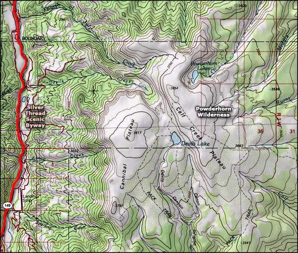
Among the 45 miles of hiking trails that access the seldom-visited Powderhorn Wilderness are the Powderhorn Lakes, East Fork, Powderhorn Park, North Calf Creek, Canyon Inferno and Devil's Lake Trails. Points of interest for fishermen and photographers include the Powderhorn Lakes and Devil's Lake.
The plateau that makes up most of Powderhorn Wilderness is a thick deposit of volcanic lava and ash, deposited during the days of San Juan Mountain building during the Tertiary era. This area is now the headwaters of several different creeks, most of which eventually empty into the Lake Fork of the Gunnison River.
There is a proposal in front of Congress to add another 3,390 acres of BLM property to the wilderness area. The proposed addition lies to the west and north of the already designated wilderness: between the wilderness boundary and the Silver Thread Scenic Byway north of Lake City.

Powderhorn Wilderness map

Powderhorn Wilderness area map
Alpine Loop Back Country Byway - Uncompahgre Wilderness
Weminuche Wilderness - La Garita Wilderness - Wheeler Geologic Area
Slumgullion Pass and Earthflow - Lake San Cristobal
National Park Service Sites - BLM Sites - National Wilderness Areas - Unique Natural Features
Outdoor Sports & Recreation - Ski & Snowboard Areas - Photo Galleries - Colorado Mountains
