|
|||
Zapata Falls National Recreational Area |
|||
|
|
|||
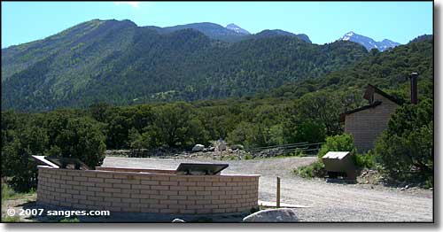
 The view north from the parking area |
|||
|
|
|||
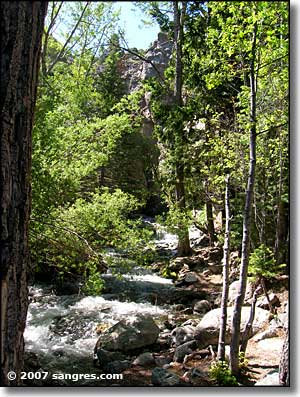
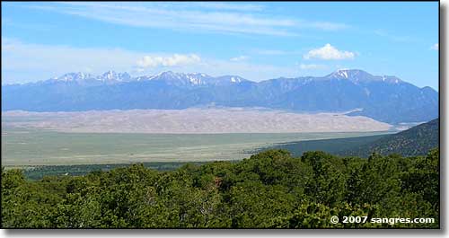
Zapata Falls is located 4 miles east of Colorado Highway 150, just south of the entrance to Great Sand Dunes National Park. The gravel road going in is excellent for a BLM site. From the parking area it is about a 1/2 mile walk uphill to the falls. As you are well above the San Luis Valley floor and looking over the sand dunes, the views are excellent. Two million years ago glacial activities were sculpting the Sangre de Cristos. The waterfall flows through a rock dike left by a retreating glacier. As the glacier melted away, a large lake of meltwater built up behind the dike. Eventually, the water found a weak spot in the dike and began working and eroding its' way through. The photo on the left was taken about 100 feet from the rock wall, where the stream flows out. Downstream just a short distance is "Lake of the Falls," a small pond created by a water gate that feeds into a high-pressure suction pipeline. As beautiful as the little pond looks, that suction pipe makes that body of water very dangerous to play in. The water that enters that pipe is shipped across the valley and flows into the Rio Grande south of all the various irrigation structures that have removed most water from the river. This added water flow is meant to traverse the countryside all the way to Mexico, to be used to satisfy the requirements of a water agreement between the United States and Mexico regarding sustaining the natural historic flows of the river. |
|||
 The rock wall (an ancient glacial moraine) that creates the falls, from the parking area 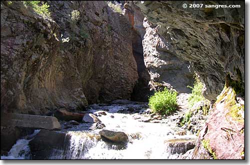 The stream's exit point from the glacial moraine that creates the falls |
|||
  |
|||
|
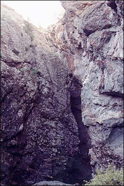
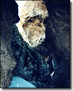
The photo on the left above was taken at the entrance to the rock gorge carved by the water. The photo on the right was taken inside the gorge. To get there I walked across the frozen and flowing streambed into the gorge. The gorge is open up above but you can't always see the sky. And it was probably 30 degrees colder in the gorge with a stiff breeze blowing downstream (there was almost no wind outside the gorge). |
|||
  |
|||
|
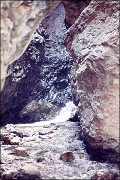
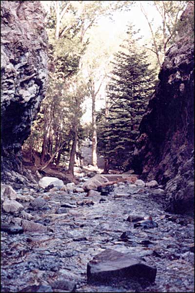
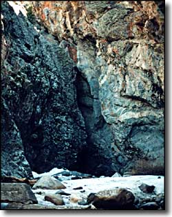
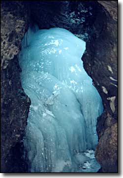
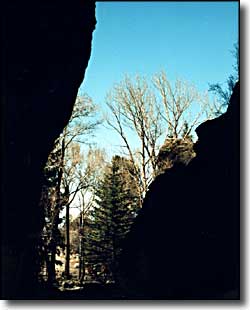
The photo on the left above is looking up through the top of the waterfall. There is more blue ice over there but the falls were flowing pretty good and everything was very slippery. The photo on the right was taken on the way back out, looking out through the gorge. |
|||
| Selecting one of the photos below will open a new window or new tab in your browser And bring you a larger version of that photo. |
|||
| |||
|
There are trails all around for hiking and viewing wildlife. The location is also in the drainage between California Peak (13,848') and Twin Peaks (13,679') on the west side of the ridge from Ellingwood Point and Blanca Peak, if you are interested in doing some climbing. |
|||
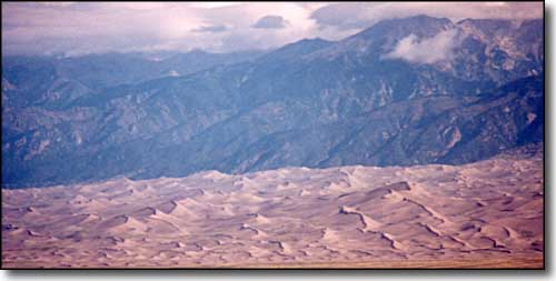 Looking down on the Sand Dunes from Zapata Falls 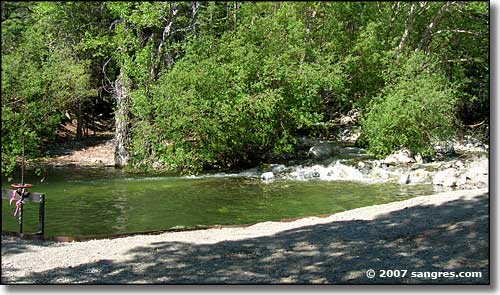 Lake of the Falls 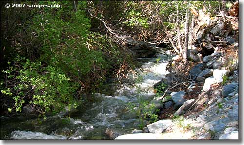 Just below Lake of the Falls 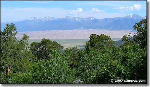 Another view of the Great Sand Dunes to the north 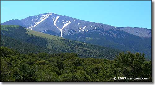 Twin Peaks Mountain, to the south 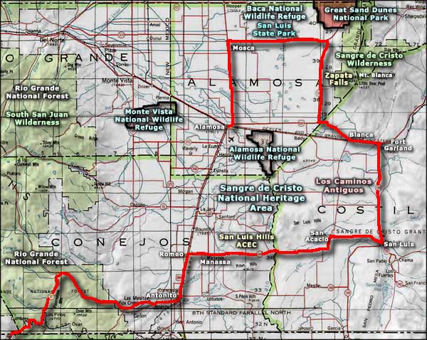 Zapata Falls National Recreation Area area map |
|||
|
|
|||
Zapata Falls Related Pages
San Luis Valley - Great Sand Dunes National Park - Zapata Ranch - Mt. Blanca
Rio Grande National Forest - Alamosa County - Sangre de Cristo Wilderness Sangre de Cristo National Heritage Area - Los Caminos Antiguos Baca National Wildlife Refuge - Alamosa National Wildlife Refuge Monte Vista National Wildlife Refuge - San Luis Lake State Park South San Juan Wilderness Colorado Pages
Towns & Places - Scenic Byways - State Parks - BLM Sites - History & Heritage
Ski & Snowboard Areas - Photo Galleries - Colorado Mountains - Scenic Railroads Unique Natural Features - Wilderness Areas - Outdoor Sports & Recreation Colorado's National Forests - National Wildlife Refuges - Colorado's National Parks |
|||
 |
|||
| Index - Arizona - Colorado - Idaho - Montana - Nevada - New Mexico - Utah - Wyoming National Forests - National Parks - Scenic Byways - Ski & Snowboard Areas - BLM Sites Wilderness Areas - National Wildlife Refuges - National Trails - Rural Life Sponsor Sangres.com - About Sangres.com - Privacy Policy - Accessibility |
|||
| Photos courtesy of Sangres.com, CCA ShareAlike 3.0 License. Area map courtesy of National Geographic Topo! All text Copyright © by Sangres.com. All rights reserved. |