 |
Kuna, Idaho |
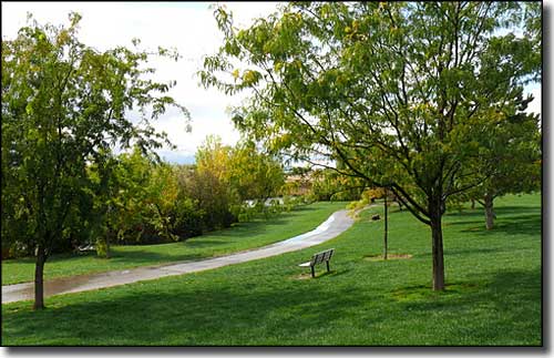 The park next to Indian Creek in Kuna |
|
Kuna began life as the end of a railroad line that was supposed to be going to Boise. For many years there was also a stage coach line that ran a regular schedule between the mining camp at Silver City (maybe 8 miles south of Kuna) and the mining camp at Idaho City on the other side of Boise. Over time an agricultural economy grew up and the settlement at Kuna grew slowly. The population started to pick up in the 1990's as more and more high-tech industry was attracted to nearby Nampa and Boise and workers gravitated more to the relative peace and quiet of Kuna. Between 2000 and 2006, Kuna more than doubled in population. Most folks get to the Morley Nelson Snake River Birds of Prey National Conservation Area by going through Kuna. The Western Heritage Historic Byway also passes through Kuna on its way south to Swan Falls Dam. |
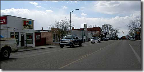 On Main Street in Kuna |
| Fast Facts about Kuna, Idaho |
|
Kuna, Ada County, ID 83634
Elevation: 2,694' Latitude: 43.4931°N Longitude: 116.4189°W Resident Racial Breakdown: White Non-Hispanic: 84.8% Hispanic: 10.9% African-American: 1.0% Asian: 0.5 Native American: 0.1% Other: 0.1% Two or More Races: 2.5% Education: High School or Higher: 89.0% Bachelor's Degree or Higher: 14.7% Graduate or Professional Degree: 2.4%
2009 Estimates: Population: 6,612 Males: 3,247 Females: 3,365 Median Resident Age: 26.1 Years Estimated Median Household Income: $48,900 Estimated Median Home Value: $155,350 Population Density: 2,764 People per Square Mile 2011 Cost of Living Index for Kuna: 91.3 Major Industries: Construction, Computer & Electronic Products, Educational Services, Lodging & Food Services, Government, Building Materials, Repair & Maintenance, Health Care, Social Services Unemployed (March 2011): 9.1% |
|
|
 |
| Index - Arizona - Colorado - Idaho - Montana - Nevada - New Mexico - Utah - Wyoming National Forests - National Parks - Scenic Byways - Ski & Snowboard Areas - BLM Sites Wilderness Areas - National Wildlife Refuges - National Trails - Rural Life Advertise With Us - About This Site - Privacy Policy |
| Photo of downtown Kuna, Idaho courtesy of Jeremy Reeder, CCA ShareAlike 3.0 License. Text Copyright © by Sangres.com. All rights reserved. |