 |
Moyie Springs, Idaho |
 |
|
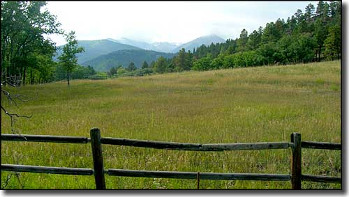
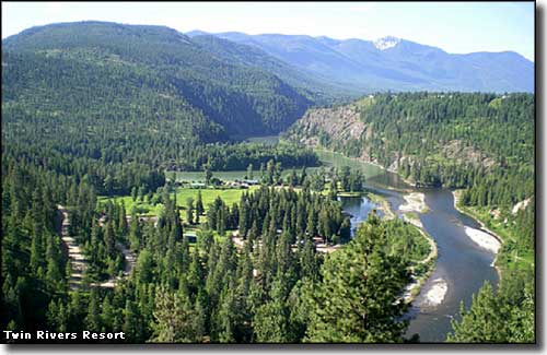
Moyie Springs is located east of Bonners Ferry on US Highway 2, near the confluence of the Moyie and Kootenai Rivers in beautiful northern Idaho. This is an area well-known for its timber products and its recreational possibilities. The first Europeans in the area were traveling in company with David Thompson in 1808. They were British fur trappers and explorers, although the word "Moyie" supposedly comes from a corruption of the French word "mouillé" meaning "wet" or "damp." The Moyie River is one of Idaho's hidden gems, seeing a lot of whitewater rafting during May and June every year. Just be careful you don't get too far south on the river and end up on top of Moyie Falls... |
 This is about 1 mile east of Moyie Springs |
| Fast Facts about Moyie Springs, Idaho |
|
Moyie Springs, Boundary County, ID 83845
Elevation: 2,215' Latitude: 48.7246°N Longitude: 116.1936°W Resident Racial Breakdown: White Non-Hispanic: 93.3% Hispanic: 4.0% Other: 2.6% Education: High School or Higher: 83.5% Bachelor's Degree or Higher: 10.5% Graduate or Professional Degree: 2.8%
2009 Estimates: Population: 731 Males: 342 Females: 389 Median Resident Age: 32.4 Years Estimated Median Household Income: $35,600 Estimated Median Home Value: $159,900 Population Density: 482 People per Square Mile 2011 Cost of Living Index for Moyie Springs: 86.7 Major Industries: Health Care, Wood Products, Lodging & Food Services, Agriculture, Forestry, Educational Services, Government, Construction, Social Services, Entertainment & Recreation Unemployed (March 2011): 17.6% |
|
|
 |
| Index - Arizona - Colorado - Idaho - Montana - Nevada - New Mexico - Utah - Wyoming National Forests - National Parks - Scenic Byways - Ski & Snowboard Areas - BLM Sites Wilderness Areas - National Wildlife Refuges - National Trails - Rural Life Advertise With Us - About This Site - Privacy Policy |
| Upper photo courtesy of Sangres.com, CCA ShareAlike 3.0 License. Lower photo courtesy of Twin Rivers Resort. Text Copyright © by Sangres.com. All rights reserved. |