 |
Sacajawea Historic Byway |
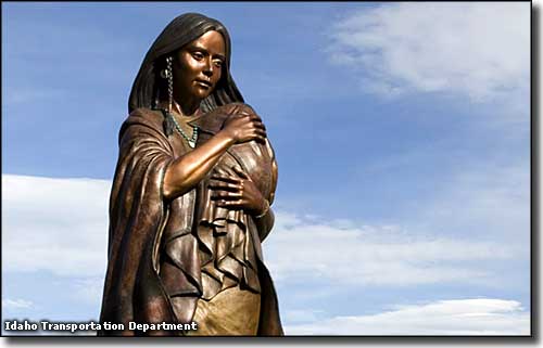 The Sacajawea Monument in Salmon |
The Sacajawea Historic Byway follows Idaho Highways 28 and 33, connecting Salmon with Interstate 15 about 24 miles north of Idaho Falls. This 132-mile route parallels almost 100 miles of the Continental Divide atop the Beaverhead/Bitterroot Mountains to the east. It drives past Tendoy (and the junction with the Lewis & Clark Back Country Byway), Lemhi and Leadore in the Salmon-Challis National Forest before crossing Gilmore Summit, emerging onto the Snake River Plain and passing the Idaho National Laboratory, then making the run past the Mud Lake Wildlife Management Area to the Interstate. This is the homeland of Sacajawea. Most folks remember her for the role she played in guiding the Lewis & Clark Expedition from North Dakota to the Pacific Ocean and back. Few people realize she made the trip with a newborn infant (Jean Baptiste Charbonneau) strapped to her back. Sacajawea was born in the Lemhi Valley around 1788 but was kidnapped in a raid by the Hidatsa Indians on her birth village at the age of 12. The Hidatsa took her back with them to the Mandan villages in North Dakota where she met and married her husband, Toussaint Charbonneau (a French-Canadian trapper and interpreter), a few years later and gave birth at the age of 17, just before the Corps of Discovery set out from North Dakota to find the Pacific Ocean. 
Her husband had been hired as a guide by Lewis & Clark, and both leaders felt that she would be a valuable asset on the journey, especially when they would come to Shoshone territory and might need to negotiate with the tribe for horses. They also knew that Indian war parties did not travel with women or children and the fact that she and her baby traveled with them would bear witness to their peaceful intentions on the journey. The Lemhi Shoshone and their forebears have lived in the Lemhi, Salmon and Birch River valleys for at least 10,000 years. The Lemhi County Museum in Salmon has an extensive collection of artifacts: arrowheads, beadwork, clothing and ceremonial accessories, many found in archaeological digs throughout the area. Along the path of the Sacajawea Historic Byways are many panels of rock art left over from those days before the arrival of Europeans in the area. Paleontologists have also found fossils of the North American lion in this area. 
Most of the settlements in these mountains and valleys revolved around mining, often lead, silver and zinc. The ghost town of Gilmore was one of these, and the charcoal kilns near the edge of town bear mute testimony to the old days. Charcoal was used in the smelter that processed lead and silver ore, but charcoal production stopped in 1889 during manipulations of the stock and commodity markets back East that drastically reduced the values of silver and lead, and many of these old towns (and their mines) were abandoned. In the area of Mud Lake, Idaho Highway 28 gives way to Highway 33 for the last 12 miles east to the Interstate. Mud Lake is home to the Mud Lake Wildlife Management Area, an 8,853-acre wetland operated by Idaho Fish & Game to help preserve and improve nesting habitat for sandhill cranes, trumpeter swans, Canada geese and multitudes of ducks and other waterfowl. Northeast of Mud Lake is the Camas National Wildlife Refuge. Parallel to the Sacajawea Historic Byway but higher up in the mountains are sections of three national trails: the Continental Divide National Scenic Trail, the Nez Perce National Historic Trail and the Lewis & Clark National Historic Trail. The Salmon-Challis National Forest ranger station in Leodore offers exhibits with information and maps of all three. |
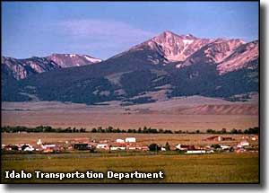
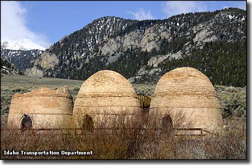 Charcoal kilns near Gilmore, Idaho  Salmon, Idaho 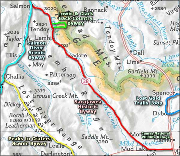 Sacajawea Historic Byway area map |
|
|
 |
| Index - Arizona - Colorado - Idaho - Montana - Nevada - New Mexico - Utah - Wyoming National Forests - National Parks - Scenic Byways - Ski & Snowboard Areas - BLM Sites Wilderness Areas - National Wildlife Refuges - National Trails - Rural Life Advertise With Us - About This Site - Privacy Policy |
| Photos courtesy of the Idaho DOT and Idaho Tourism. Area map courtesy of National Geographic Topo! Small photo of Shoshone at Sacajawea Center courtesy of the Bureau of Land Management. Text Copyright © by Sangres.com. All rights reserved. |