 |
Gallatin National Forest |
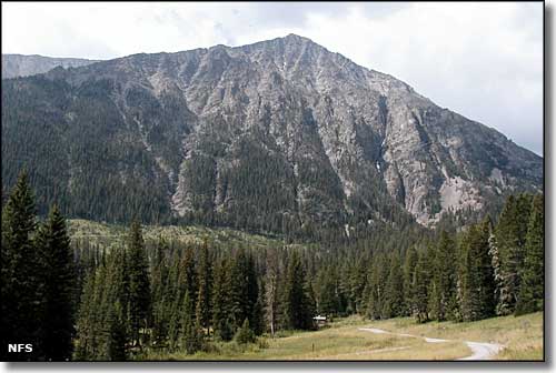 |
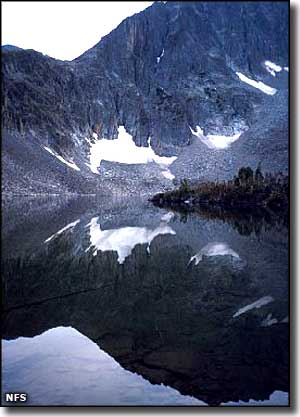
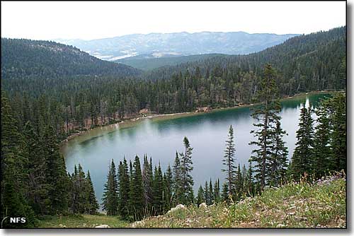
Gallatin National Forest is comprised of 2.1 million acres spanning 6 mountain ranges and includes parts of 2 designated wildernesses: the Lee Metcalf and the Absaroka-Beartooth in the Greater Yellowstone Area. Gallatin National Forest was established in 1899 as part of the largest intact ecosystem in the 48 contiguous states. These snow-capped mountain peaks and blue-ribbon trout streams are just part of the whole, because this is also prime habitat for gray wolf, bald eagle, Canada lynx, grizzly bear, mule deer, white-tailed deer, moose, elk, mountain lion, black bear, pronghorn, bighorn sheep, bison, coyote, and wolverine. As usual in a western National Forest, a significant portion of the property is covered with native grasses and sagebrush. Higher elevations support populations of Douglas fir, aspen, cottonwood and several species of spruce. The Gallatin National Forest has more than 4,000 miles of streams and rivers, making this area one of the preeminent fly-fishing regions in the world. Among those flowing waters are several major tributaries of the Missouri and Yellowstone Rivers. The forest also contains more than 700 high mountain lakes and reservoirs. There are also more than 2,290 miles of trails in the Gallatin National Forest. Many of these trails provide access to the wilderness areas and interlink with trails in Yellowstone National Park. Gallatin offers nearly 40 developed campgrounds, plus numerous picnic areas and rentable Forest Service cabins. |
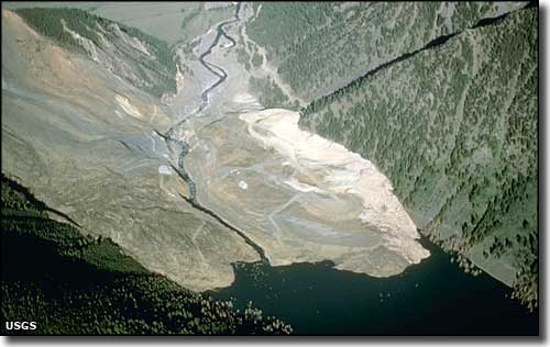 Aerial view of the landslide that created Quake Lake in 1959 |
|
Quake Lake on the Madison River was formed by an earthquake and landslide in 1959. The earthquake killed 28 people and the landslide created a lake 6 miles long and 190 feet deep. Measuring 7.3 on the Richter scale, that earthquake dropped the bottom of Hebgen Lake some 20' while it raised fault scarps 20' high near the lake. Another 32,000 acres of land near Hebgen Lake subsided at least 10'. Most of the people who died were camping along the shores at Hebgen Lake and they died when the waters of the lake shifted violently. Aftershocks registering up to 6.5 went on for months afterward. The dam itself was washed over by the heaving waters and developed some serious cracks. The Army Corps of Engineers mobilized quickly and patched the dam before there were any problems. Then they acted to create a spillway for Quake Lake before the rapidly rising waters could blow out that natural dam and cause more problems downstream. |
 |
|
|
 |
| Index - Arizona - Colorado - Idaho - Montana - Nevada - New Mexico - Utah - Wyoming National Forests - National Parks - Scenic Byways - Ski & Snowboard Areas - BLM Sites Wilderness Areas - National Wildlife Refuges - National Trails - Rural Life Advertise With Us - About This Site - Privacy Policy |
| Photos of Gallatin National Forest are courtesy of the National Forest Service. Photo of the landslide at Quake Lake courtesy of the USGS. Text Copyright © by Sangres.com. All rights reserved. |