 |
Great Bear Wilderness |
 |
|
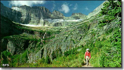
The 286,700 acres of Great Bear Wilderness run from Glacier National Park on the north to Bob Marshall Wilderness on the south. The only thing separating Great Bear Wilderness from Glacier National Park is the US Highway 2 corridor. But Great Bear together with Bob Marshall and Scapegoat Wilderness (on the south side of Bob Marshall Wilderness) comprise the 1.5 million-acre Bob Marshall Wilderness Complex. Lying right against the western side of the Continental Divide, about 50 miles of the Wild and Scenic Upper Middle Fork of the Flathead River runs through the Great Bear Wilderness. Known as "Montana's wildest waterway," this piece of river roars through boulder-filled rapids at the foot of miles of extreme cliff faces. This is a heavily glaciated, extremely rugged mountain landscape filled with deer, moose, elk, lynx, wolverine, black bear, bighorn sheep, mountain goat and grizzly bear. There are more than 300 miles of trails in Great Bear Wilderness but the interior of the property has no trails and is almost untouched by humans. Something to look out for when hiking here: nearly all trails have frequent stream crossings and these can be quite dangerous during spring snow-melt and summer rains. Usually, most of the snow is melted off by mid-May but some higher-up snowfields are essentially permanent. You want to be well-versed in wilderness survival skills and be properly equipped before heading into these woods. This countryside is a mix of large, gently sloped alpine meadows, heavily forested river bottoms and sheer, stark cliffs in between. Rumor has it the mountain climbing, back country skiing, hunting and fishing are world-class. Highest point on the property: Great Northern Mountain (8,705') in the Flathead Range west of the Continental Divide. |
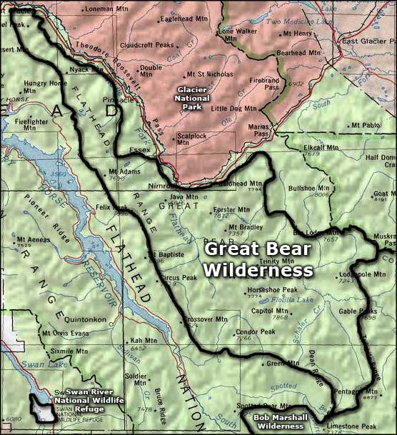 Area map of Great Bear Wilderness |
|
|
 |
| Index - Arizona - Colorado - Idaho - Montana - Nevada - New Mexico - Utah - Wyoming National Forests - National Parks - Scenic Byways - Ski & Snowboard Areas - BLM Sites Wilderness Areas - National Wildlife Refuges - National Trails - Rural Life Advertise With Us - About This Site - Privacy Policy |
| Photo of the Chinese Wall courtesy of the National Forest Service. Map courtesy of National Geographic Topo! Text Copyright © by Sangres.com. All rights reserved. |