 |
Lake Mason National Wildlife Refuge |
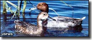
Lake Mason National Wildlife Refuge (16,659 acres) is composed of 4 disjoint sections: 1 around the shores of Lake Mason and the other three upstream on South Willow Creek in northwestern Musselshell County. These are typical wetland areas surrounded by grassy prairie uplands that have been protected for their value to more than 100 species of migratory waterfowl and other birds. There is very little information available about Lake Mason National Wildlife Refuge and, judging from what I can see on a good map, none of these properties has public access as they are most likely conservation easements on private land. Lake Mason itself is about 1,300 acres of natural marsh in the heart of the usual Montana shortgrass prairie hills, about 8 miles northwest of the town of Roundup. |
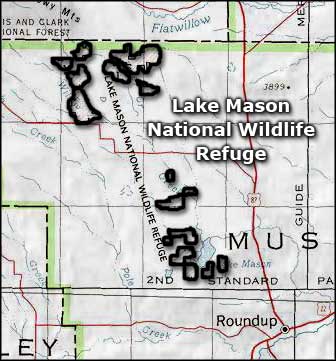 Lake Mason National Wildlife Refuge area map |
|
|

|
| Index - Arizona - Colorado - Idaho - Montana - Nevada - New Mexico - Utah - Wyoming National Forests - National Parks - Scenic Byways - Ski & Snowboard Areas - BLM Sites Wilderness Areas - National Wildlife Refuges - National Trails - Rural Life Advertise With Us - About This Site - Privacy Policy |
| Photo of ducks on the water courtesy of the US Fish & Wildlife Service. Map courtesy of National Geographic Topo! Text Copyright © by Sangres.com. All rights reserved. |