|
|||||||||||||||
|---|---|---|---|---|---|---|---|---|---|---|---|---|---|---|---|
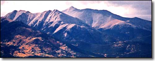
Mount AnteroSawatch Mountains - Collegiate Peaks, Central Colorado |
|||||||||||||||
|
|
|||||||||||||||
|
|||||||||||||||
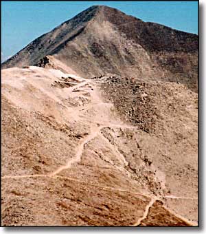
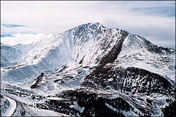
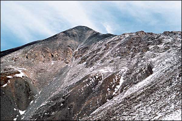
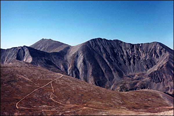
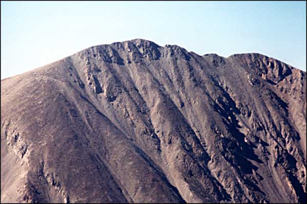
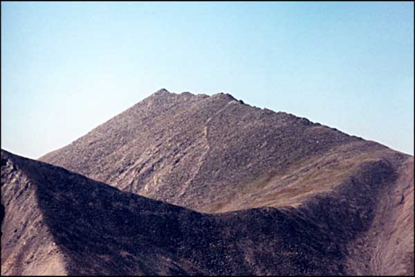
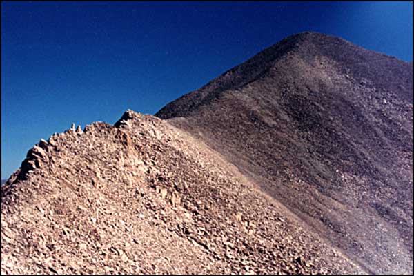
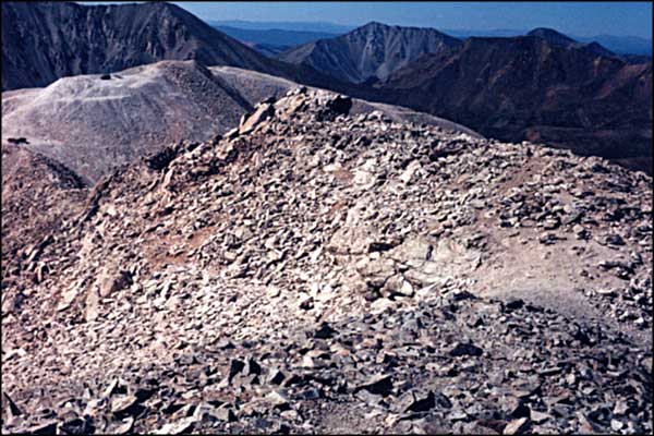
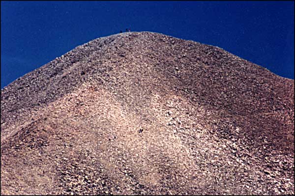
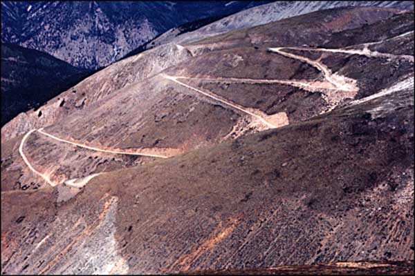
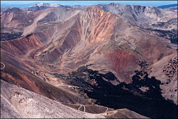
Mount Antero is named after a Native American chief of the Uintah Nation. Antero is more famous among gem collectors than among mountaineers. While you are hiking you may want to watch the ground you are crossing (especially above 13,700 feet) because some incredible surprises are still lying there, waiting for your touch. Most folks climb the mountain using the 4x4 road that goes up Baldwin Gulch to a shoulder south of Antero's summit at about 13,700'. In the photo on the left (taken from the south), the road climbs Mt. White (13,667') and the summit of Antero is in the background. Bill and I got a chance to talk a walk on Mt. Antero in mid November, 2001. We didn't get anywhere near the summit (a breeze at about 12,800 ft. almost knocked us off the mountain) but for mid November, we had a great hike. We went in by the Baldwin Gulch trailhead and just hiked up the road. We didn't find anywhere where the road wasn't driveable by a normal 4x4 although there's a pretty good stream crossing just below Baldwin Lake. The weather report that day in Buena Vista said "Clear below 12,000 feet" and it meant it. Above 12,000 ft. we were in and out of the clouds and the breeze just got worse and worse as we went. We had a late start that morning anyway so we weren't trying really hard to bag the peak. A couple good gusts of wind were enough to start us back down the mountain in the early afternoon, well short of the summit. Next year will be different. Yes, next year is different. It's August and we drive up to Baldwin Lake easily and camp. In the morning, there's ice on the logs of the stream crossing. There's also quite the assortment of vehicles driving up and down the hill heading for the gemstone digs at 14,000 feet. But Bill and I walk the distance. There's roads all over the mountain until you get to the gemstone digs. That's on a shoulder of the hill at about 14,000 feet. The closer we got to that point, the more folks we ran into. There were quite a few kids and dogs in that area, too. But once we got clear of the final cul-de-sac, we were right back in the mountains. Antero is a big stock (an igneous intrusion), like the Spanish Peaks and Mt. Mestas. The stock includes Mt. White (just to the south and also mined heavily) and the north face of Tabeguache/Shavano/Jones Peak. The hardest part of the remaining climb to the summit was deciphering the trail braiding. Quite a few people forgot about the trail and went straight up over the rocks and loose stuff to the summit. It was a gorgeous day and a great hike. |
|||||||||||||||
| Selecting one of these photos will open a new window or new tab in your browser and bring you a larger version of that photo. |
|||||||||||||||
| |||||||||||||||
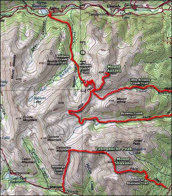 Mount Antero area map |
|||||||||||||||
|
|
|||||||||||||||
Mt. Antero Related PagesSan Isabel National Forest PagesColorado Pages
Towns & Places - Scenic Byways - State Parks - BLM Sites - History & Heritage Ski & Snowboard Areas - Photo Galleries - Colorado Mountains - Scenic Railroads Unique Natural Features - Wilderness Areas - Outdoor Sports & Recreation Colorado's National Forests - National Wildlife Refuges - Colorado's National Parks |
|||||||||||||||

|
|||||||||||||||
| Index - Arizona - Colorado - Idaho - Montana - Nevada - New Mexico - Utah - Wyoming National Forests - National Parks - Scenic Byways - Ski & Snowboard Areas - BLM Sites Wilderness Areas - National Wildlife Refuges - National Trails - Rural Life Advertise With Us - About This Site - Privacy Policy |
|||||||||||||||
| Photos courtesy of Sangres.com, CCA ShareAlike 3.0 License. Map courtesy of National Geographic Topo! Text Copyright © by Sangres.com. All rights reserved. |