 |
|---|
Mount LindseySangre de Cristo Mountains |
|
|
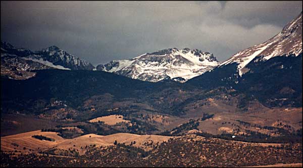
 Mount Lindsey from near Fort Garland, Colorado |
Mount Lindsey is located on private land. The owners allow access to the summit only from above treeline. That means coming in through the Huerfano Valley and climbing the trail up Nipple Creek to the ridge joining Mount Lindsey and the Iron Nipple. That leads onto the northwest ridge and north face, neither of which is pictured here. These photos are from the south side, the side from which most people view Lindsey. Photos from the climb to the ridge near the Iron Nipple can be found at Sierra Blanca. The photo at the left is of Point 13,100, on the ridge between the Iron Nipple and Gash Ridge, (climb rating: 5.0-5.2) which leads to Blanca Peak. Click on the photo and you'll get a larger version. |
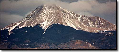 Mount Lindsey in February, 2000, the southwest face 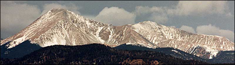 Mount Lindsey and Point 13,858 (Huerfano Peak) from the southeast (Huerfano Peak is one of the 100 highest peaks in Colorado.) Panoramic version of above photo. |
|
|
Mt. Lindsey Related PagesColorado Pages
Towns & Places - Scenic Byways - State Parks - BLM Sites - History & Heritage Ski & Snowboard Areas - Photo Galleries - Colorado Mountains - Scenic Railroads Unique Natural Features - Wilderness Areas - Outdoor Sports & Recreation Colorado's National Forests - National Wildlife Refuges - Colorado's National Parks |

|
| Index - Arizona - Colorado - Idaho - Montana - Nevada - New Mexico - Utah - Wyoming National Forests - National Parks - Scenic Byways - Ski & Snowboard Areas - BLM Sites Wilderness Areas - National Wildlife Refuges - National Trails - Rural Life Advertise With Us - About This Site - Privacy Policy |
| Photos courtesy of Sangres.com, CCA ShareAlike 3.0 License. Text Copyright © by Sangres.com. All rights reserved. |