|
|||||||||||||||
|---|---|---|---|---|---|---|---|---|---|---|---|---|---|---|---|
Mt. MaxwellSangre de Cristo Mountains |
|||||||||||||||
|
|
|||||||||||||||
 From left to right: Mts. Mariquita, Maxwell and Cuatro, North Lake in the foreground. |
|||||||||||||||
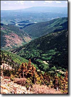
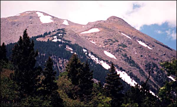
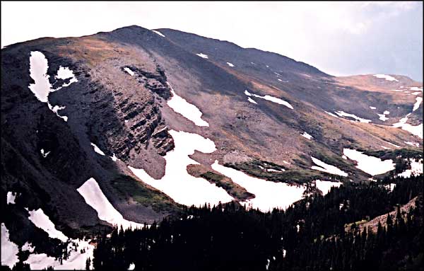
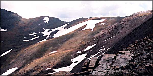
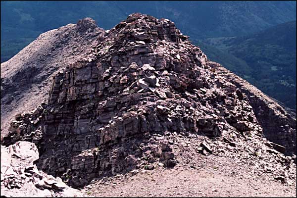
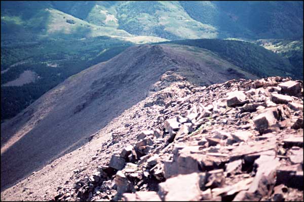
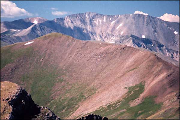
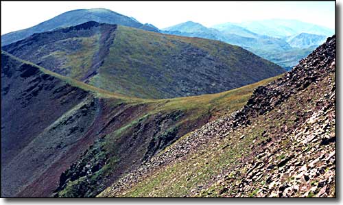
Mt. Maxwell is on the boundary between the San Isabel National Forest on its' eastern slopes and private land on its' western and southern slopes. It also marks the southwestern corner of the San Isabel National Forest. (Originally, it was the northwestern corner of the Maxwell Land Grant.) The photo on the left was taken above treeline on Mt. Maxwell's shoulder. The view is looking southeast down the canyon of the North Fork of the Purgatoire River. On the horizon is Fisher's Peak and Raton Mesa. The ridge leading south from Trinchera Peak to Mt. Maxwell doesn't look too bad but I haven't walked it yet. There is lots of exposure, depending on which side of the exposed fault line you choose to walk on. The photo below shows that ridge, from the top of Trinchera Peak looking south. Mt. Mariquita, the next peak to the south along the high ridge, is entirely on private land. The western side of the top ridge of the Sangres here is cliffbands and steep talus. |
|||||||||||||||
 |
|||||||||||||||
|
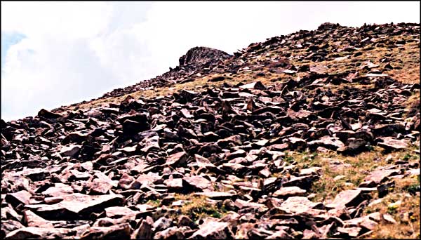
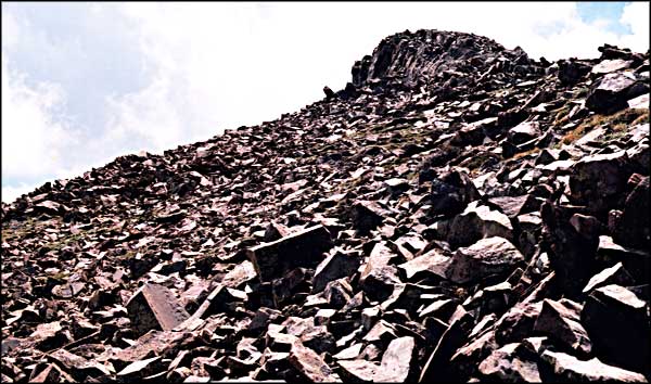
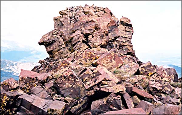
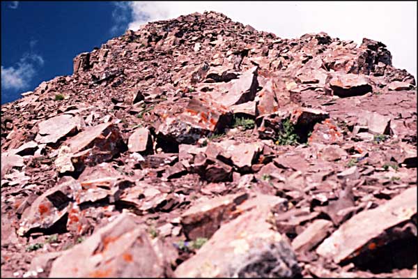
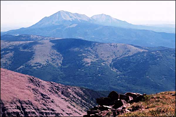
The photos below were taken one day while I was getting some exercise on Mt. Maxwell. There's a jeep trail that leads uphill from just below the Purgatoire Campground. The road is quite drivable (except the last quarter mile) but has a lot of switchbacks. And it's way up the mountain before you start to get some real views. The road dies at treeline. There's no trail beyond there but as you go up the hill, the available alternate paths quickly disappear. You are forced closer and closer to the center of the shoulder until you reach the boulderfield. Very few choices here. Lots of exposure, good cliff bands everywhere and a big mound of rocks. And, oh yeah, there's a couple of false summits to help you out along the way. The true summit is finally marked with a large hunk of pipe stuck out of the ground in the center of a rock cairn. I'm assuming that also marks the end of the National Forest and the beginning of private land to the west and south. The western side of the mountain drops off in cliff bands and what looks to be rotten rock and steep talus. |
|||||||||||||||
| Clicking on any of these photos will open a new window or new tab in your browser and bring you a larger version of that photo. |
|||||||||||||||
| |||||||||||||||
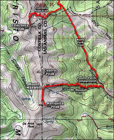 Mount Maxwell area map |
|||||||||||||||
|
|
|||||||||||||||
Mt. Maxwell Related PagesSan Isabel National Forest PagesColorado Pages
Towns & Places - Scenic Byways - State Parks - BLM Sites - History & Heritage Ski & Snowboard Areas - Photo Galleries - Colorado Mountains - Scenic Railroads Unique Natural Features - Wilderness Areas - Outdoor Sports & Recreation Colorado's National Forests - National Wildlife Refuges - Colorado's National Parks |
|||||||||||||||

|
|||||||||||||||
| Index - Arizona - Colorado - Idaho - Montana - Nevada - New Mexico - Utah - Wyoming National Forests - National Parks - Scenic Byways - Ski & Snowboard Areas - BLM Sites Wilderness Areas - National Wildlife Refuges - National Trails - Rural Life Advertise With Us - About This Site - Privacy Policy |
|||||||||||||||
| Photos courtesy of Sangres.com, CCA ShareAlike 3.0 License. Map courtesy of National Geographic Topo! Text Copyright © by Sangres.com. All rights reserved. |