|
||||||
|---|---|---|---|---|---|---|
Blanca Peak Traverses |
||||||
|
|
||||||
|
||||||
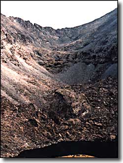
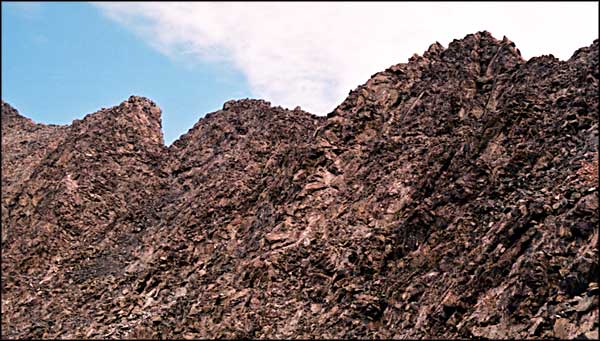
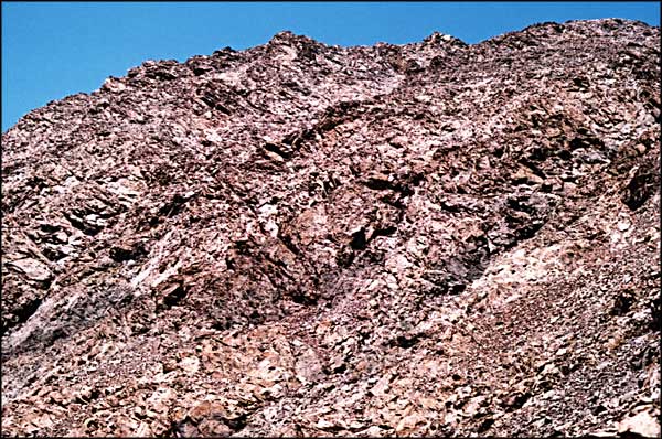
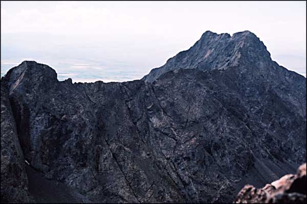
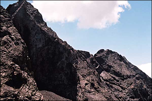
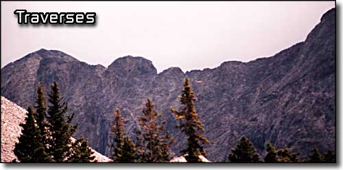
The traverses between Ellingwood Point, Blanca Peak and Little Bear are excellent examples of what serious glaciation leaves behind. The photo on the left is of the ridge and bowl between Ellingwood and Blanca. You can see the boulderfields, broken cliff bands, talus, and towers along the ridge. The north face of the ridge is a sheer drop of 1000 to 1500 feet, depending on where you are on the ridge. The ridge traverse is rated a Class 3, meaning hand and foot climbing with some exposure. We did the traverse by dropping down below the upper cliffs and towers and crossing the face on ledges. Then we went back up to the ridge and climbed the ridge to Ellingwood Point. The trail back was similar except Furi led the way down and we went pretty directly down the hill until we came to the main trail just above the broken cliff bands. The ridge from Little Bear to Blanca Peak is another story. Gerry Roach calls it "Colorado's most astonishing connecting ridge." It's a doubly exposed ridge with several nasty towers. The "easiest" direction is from Little Bear to Blanca. You are two-thirds of the way across before there is any escape and that escape is down into Blanca Basin, very far from camp and vehicle. The traverse is rated Class 5.0-5.2 (which means rope, hardware, helmets, and much technical expertise). Watch the weather because it's not where you want to be in a storm. None of our crew tried it because the weather that day just wasn't conducive. |
||||||
| Clicking on any of these photos will open a new window or new tab in your browser and bring you a larger version of that photo. |
||||||
| ||||||
 Blanca Massif area map |
||||||
|
|
||||||
Blanca Massif Related Pages
Blanca Peak - Ellingwood Point - Little Bear - Lake Como - Mountain Stream
Mount Lindsey - Sierra Blanca - California Peak Como Lake Road - Zapata Falls National Recreation Area Colorado Pages
Towns & Places - Scenic Byways - State Parks - BLM Sites - History & Heritage Ski & Snowboard Areas - Photo Galleries - Colorado Mountains - Scenic Railroads Unique Natural Features - Wilderness Areas - Outdoor Sports & Recreation Colorado's National Forests - National Wildlife Refuges - Colorado's National Parks |
||||||

|
||||||
| Index - Arizona - Colorado - Idaho - Montana - Nevada - New Mexico - Utah - Wyoming National Forests - National Parks - Scenic Byways - Ski & Snowboard Areas - BLM Sites Wilderness Areas - National Wildlife Refuges - National Trails - Rural Life Advertise With Us - About This Site - Privacy Policy |
||||||
| Photos courtesy of Sangres.com, CCA ShareAlike 3.0 License. Map courtesy of National Geographic Topo! Text Copyright © by Sangres.com. All rights reserved. |