 |
Big Rocks Wilderness |
 Big Rocks Wilderness |
|
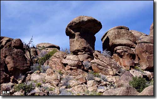
The 12,997 acres of the Big Rocks Wilderness lies in the southernmost portion of the North Pahroc Range, about 24 miles west of Caliente. This is an area of steep-sided mountains and canyons with a jumble of large boulders the Nevada rock climbing community calls "Mecca." The area is so rugged that motorized vehicles have simply never been here. Among the boulder fields you'll find multi-colored layers of welded volcanic tuff that has eroded over the millenia into some wild and crazy shapes. You'll also find lots of prehistoric rock art and primitive campsites. Elevations range from 5,200' to about 7,000'. The higher elevations carry pinon and juniper stands but the lower areas are covered with desert brush and grasses. Access to Big Rocks Wilderness is via BLM Road 2201 about 30 miles west of Caliente on US 93. BLM 2201 runs north along the western boundary, then east along the northern boundary and then south along the eastern boundary of the wilderness. |
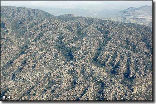 Big Rocks Wilderness from the air 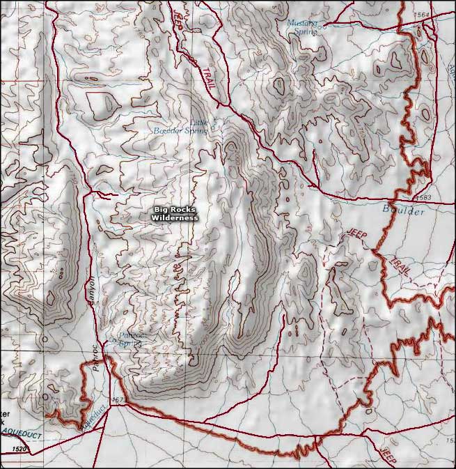 Big Rocks Wilderness map |
|
|

|
| Index - Arizona - Colorado - Idaho - Montana - Nevada - New Mexico - Utah - Wyoming National Forests - National Parks - Scenic Byways - Ski & Snowboard Areas - BLM Sites Wilderness Areas - National Wildlife Refuges - National Trails - Rural Life Advertise With Us - About This Site - Privacy Policy |
| Photos of Big Rocks Wilderness courtesy of the Bureau of Land Management. Map courtesy of National Geographic Topo! Text Copyright © by Sangres.com. All rights reserved. |