 |
Government Peak Wilderness |
 Government Peak Wilderness |
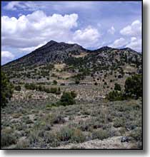
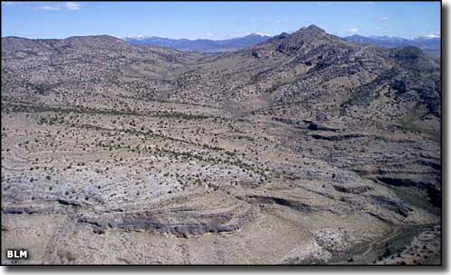
Government Peak Wilderness is composed of about 6,313 acres just beyond the northern sections of the Snake Range in northeastern White Pine County. Elevations in the wilderness range from 6,000' to 8,100' at the summit of Government Peak. The eastern part of Government Peak Wilderness is a bit heavy on the bare rock cliffs but the western part is slightly more gentle and carries scattered stands of pinon and juniper on the slopes of Government Peak and the surrounding hills, above the lower desert grasses and brush. South of Government Peak itself is Indian George Wash with an almost non-existent jeep trail through it. This jeep trail splits Government Peak Wilderness into 2 sections. Government Peak Wilderness is located about 55 miles north of Baker, Nevada. To get there: go west of Baker on US 6/50 to the intersection with Nevada Route 893. Turn and go north about 40 miles. Just beyond the end of the pavement you'll take a right and go east on CR 37. About 8 miles in you'll come to the junction with BLM Road 23: keep going straight. Go another 2 miles and take the right fork. Somewhere in here you'll start to see signs for "Closed Road" and "Wilderness." From that fork in the road it's another 14 miles to the northern tip of Government Peak Wilderness. Parking is allowed outside the wilderness boundary. |
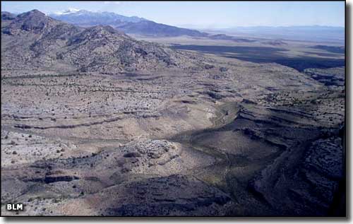 Indian George Wash 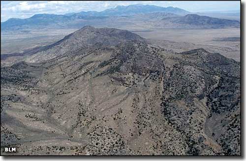 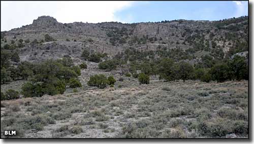 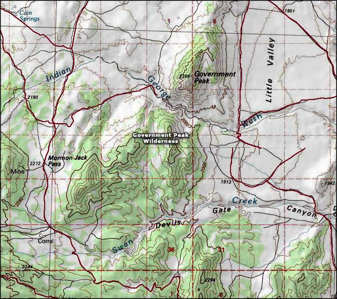 Government Peak Wilderness map |
|
|

|
| Index - Arizona - Colorado - Idaho - Montana - Nevada - New Mexico - Utah - Wyoming National Forests - National Parks - Scenic Byways - Ski & Snowboard Areas - BLM Sites Wilderness Areas - National Wildlife Refuges - National Trails - Rural Life Advertise With Us - About This Site - Privacy Policy |
| Photos of Government Peak Wilderness courtesy of the Bureau of Land Management Map courtesy of National Geographic Topo! Text Copyright © by Sangres.com. All rights reserved. |