 |
Mormon Mountains Wilderness |
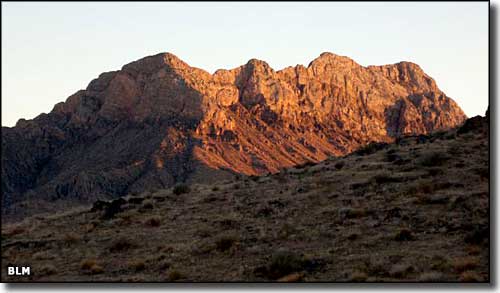 |
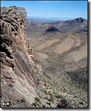
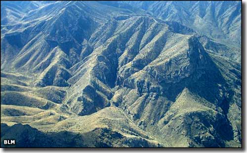
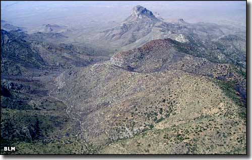
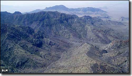
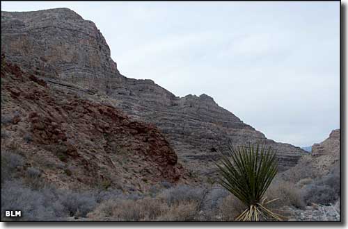
The Mormon Mountains Wilderness is a 157,938-acre property of several varying landscapes: jagged mountain peaks, deeply carved limestone canyons and rolling desert bajadas. Elevations range from 2,200' to the summit of Mormon Peak at 7,414'. The higher areas are topped with old-growth stands of Ponderosa pine while the canyons are forested with juniper and pinon pine and the lower bajadas sport yucca, cholla and Joshua trees. The climate changes quickly with the elevation and you'll find mule deer, bobcat, desert bighorn sheep and mountain lion up high with desert tortoise, kit fox and many reptilian types down below. The area also supports golden eagle, red-tailed hawk, burrowing owl, prairie falcon, northern harrier, American kestrel and many other birds of prey. The limestone walls in the Mormon Mountains are full of fossils hundreds of millions of years old, from the ancient times when this area was sea bottom and collecting sediments that rained down from above. In traveling around here you might also come across some of the thousands of archaeological sites: pictographs, petroglyphs, prehistoric campsites, grinding stones, rock shelters, agave roasting pits, etc. Access to the Mormon Mountains Wilderness from the south is via an unnamed northbound county road that exits the I-15 about 14 miles east of Glendale. Coming from the north, you can go through Caliente and continue south on State Highway 317 through Elgin and Lyman Crossing to Carp, just above the northern corner of the Mormon Mountains Wilderness. |
    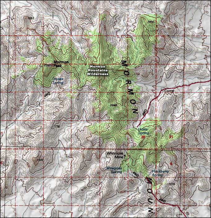 Mormon Mountains Wilderness map |
|
|

|
| Index - Arizona - Colorado - Idaho - Montana - Nevada - New Mexico - Utah - Wyoming National Forests - National Parks - Scenic Byways - Ski & Snowboard Areas - BLM Sites Wilderness Areas - National Wildlife Refuges - National Trails - Rural Life Advertise With Us - About This Site - Privacy Policy |
| Photos of the Mormon Mountains Wilderness courtesy of the Bureau of Land Management Map courtesy of National Geographic Topo! Text Copyright © by Sangres.com. All rights reserved. |