 |
North Black Rock Range Wilderness |
 North Black Rock Range Wilderness |
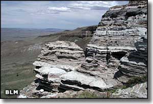
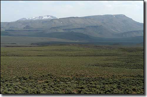
The 30,647-acre North Black Rock Range Wilderness is in the Black Rock Desert-High Rock Canyon Emigrant Trails National Conservation Area in northwestern Nevada. The northern boundary of the wilderness is against the Summit Lake Indian Reservation. Summit Lake was created on North Black Rock Range Wilderness about 20,000 years ago when a huge landslide dropped millions of tons of volcanic materials into what was then a very deep canyon. Today, the western side of Summit Lake is still overlooked by long, multi-colored cliffs of volcanic tuffs and ash. The North Black Rock Range Wilderness contains the northern part of the Black Rock Range. Elevations range from 4,800' to 8,400'. The primary vegetation in this area is sagebrush but Snow, Slumgullion, Battle and Colman Creeks also have willows, aspens, cottonwoods and other riparian vegetation in the wetter areas. Battle and Colman Creeks carry re-introduced populations of the threatened Lahontan Cutthroat trout. There are several small waterfalls in the upper reaches of Colman Creek. Wildlife in the area includes mule deer, California bighorn sheep, mountain lion, pronghorn antelope, coyote and sage grouse. The western edge of the North Black Rock Range Wilderness is accessible from the Soldier Meadows Ranch road. There are roads off the Soldier Meadows road that access the northern and eastern boundaries of the property but you'll probably want to be driving some kind of rock crawler to get there: the "roads" are extremely rough and steep. |
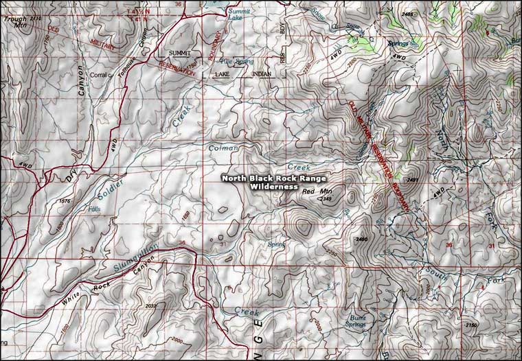 North Black Rock Range Wilderness map |
|
|

|
| Index - Arizona - Colorado - Idaho - Montana - Nevada - New Mexico - Utah - Wyoming National Forests - National Parks - Scenic Byways - Ski & Snowboard Areas - BLM Sites Wilderness Areas - National Wildlife Refuges - National Trails - Rural Life Advertise With Us - About This Site - Privacy Policy |
| Upper photo is courtesy of Chris Barns, via Wilderness.net Upper left photo is courtesy of the Bureau of Land Management. Map courtesy of National Geographic Topo! Text Copyright © by Sangres.com. All rights reserved. |