 |
Tunnel Spring Wilderness |
 Tunnel Spring Wilderness |
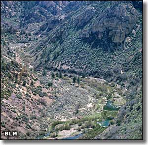
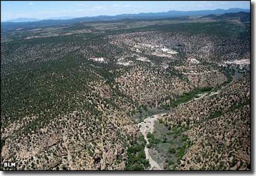
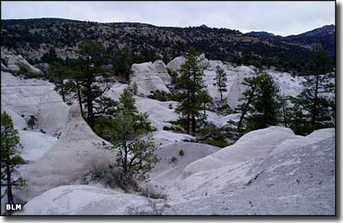
At 5,371 acres, Tunnel Spring Wilderness is one of the smaller wilderness areas in Nevada. Located on the northern side of Beaver Dam State Park, Tunnel Spring Wilderness is a mountainous area of steep canyons and rough drainages below long ridges that rise above the head of Beaver Dam Wash. The geology here is mostly of volcanic origin. The climate is semi-arid, which means hot summers and cold winters. The vegetation is primarily sagebrush and pinon-juniper. Elevations range from 5,000' to 6,700'. The easiest access to Tunnel Spring Wilderness is from the Pine Park Campground in the Dixie National Forest (Utah). The area is too rugged for horseback riding but the hiking isn't bad at all. There are a number of trails in the Pine Park Canyon, Sheep Corral Canyon and Pine Park-Split Pine Hollow areas. Just east of Tunnel Spring Wilderness is Cougar Canyon Wilderness, on the Utah side of the state line. Unusual for this area of Nevada, there are about 6 miles of perennial streams that support rainbow trout. Wildlife includes mule deer, mountain lion, coyote and the famous Merriam's kangaroo rat. Something to look out for: in their inestimable respect for the wildlands of this country, Tunnel Spring Wilderness is very close to the military flight path to and from Nellis Air Force Base. Several times a week one aircraft or another will fly by at subsonic speed as little as 100 feet above the ground. |
 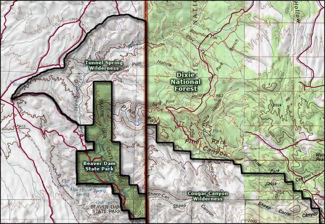 Tunnel Spring Wilderness map |
|
|

|
| Index - Arizona - Colorado - Idaho - Montana - Nevada - New Mexico - Utah - Wyoming National Forests - National Parks - Scenic Byways - Ski & Snowboard Areas - BLM Sites Wilderness Areas - National Wildlife Refuges - National Trails - Rural Life Advertise With Us - About This Site - Privacy Policy |
| Photos of Tunnel Spring Wilderness courtesy of the Bureau of Land Management. Map courtesy of National Geographic Topo! Text Copyright © by Sangres.com. All rights reserved. |