 |
California Trail Back Country Byway |
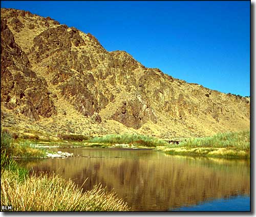 A scene along the California Trail Back Country Byway |
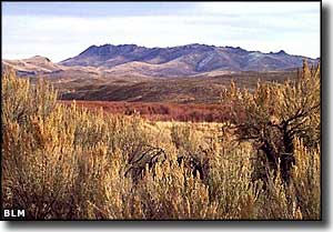
The California Trail Back Country Byway follows the route of the original California Trail, beginning from the point where it enters Nevada from Idaho in the very northeastern corner of the state. One branch heads west to Jackpot while the main route goes southwest to connect with US Highway 93 at the ghost town of Wilkins (at the turnoff to Thousand Springs). It may take you 3 hours to drive this 96-mile route, but take some time to enjoy the views and the ambience of the abandoned historical buildings, the remaining wagon ruts and the feel of a wagon road that carried probably a quarter million emigrants to their futures in California. This area is mostly BLM land so you can enjoy some hiking, backpacking, camping and mountain biking if you're up for it. |
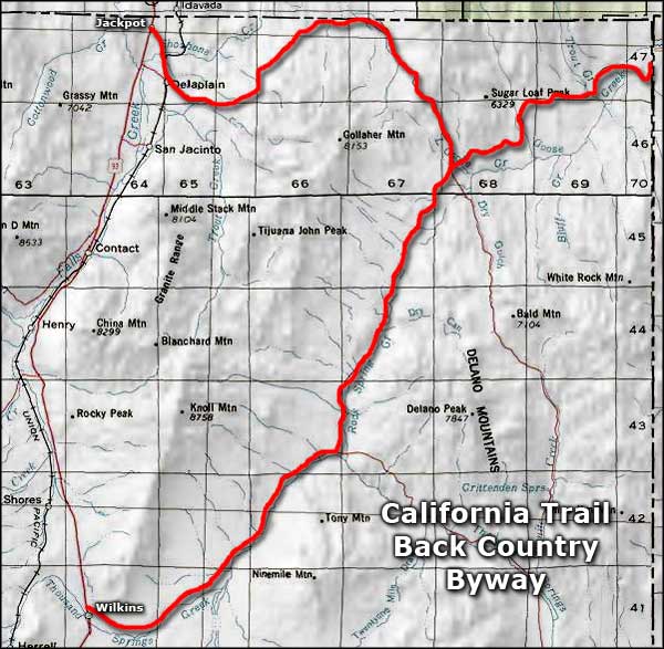 California Trail Back Country Byway area map |
|
|

|
| Index - Arizona - Colorado - Idaho - Montana - Nevada - New Mexico - Utah - Wyoming National Forests - National Parks - Scenic Byways - Ski & Snowboard Areas - BLM Sites Wilderness Areas - National Wildlife Refuges - National Trails - Rural Life Advertise With Us - About This Site - Privacy Policy |
| Photos courtesy of the Bureau of Land Management Area map courtesy of National Geographic Topo! Text Copyright © by Sangres.com. All rights reserved. |