 |
Gold Butte Back Country Byway |
 |
|
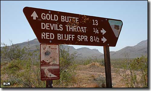
The Gold Butte Back Country Byway heads south from Interstate 15 at exit 112, about 5 miles south of Mesquite/Bunkerville and about 90 miles northeast of Las Vegas. This is a 62-mile, 4-5 hour scenic journey through some pretty serious desert in southeastern Nevada: the Gold Butte Area of Critical Environmental Concern. You'll have some great views and plenty of opportunities to see desert wildlife, ancient petroglyphs, sinkholes and red and white sandstone formations with Lake Mead and the Muddy Mountains to the west. Along the way you'll pass through the historic mining town of Gold Butte, founded in 1908. Copper, gold, zinc and lead were mined in quantity at Gold Butte but the veins played out long ago. From the Gold Butte townsite, the route loops back to rejoin the exit road near St. Thomas Gap. On the western side of the loop, you'll be traveling for several miles along the eastern boundary of the Lime Canyon Wilderness. Primitive camping and hiking are available all along the route. The 19 miles of the western loop of the byway should be accessed by high clearance 4WD vehicles only: this is not a place where you can just pull out your cell phone and call for help... Just west of Gold Butte is another BLM road that heads south into the desert. It's a 4WD route only that wraps around Jumbo Peak and dead ends at the southern boundary of the Jumbo Springs Wilderness. |
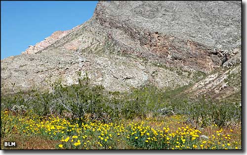 Gold Butte itself 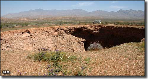 The Devil's Throat Sinkhole 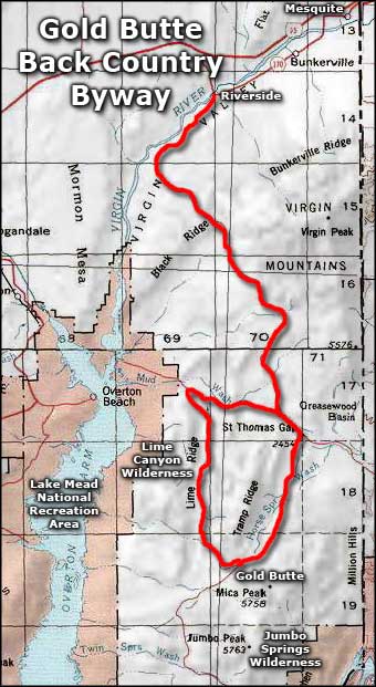 Gold Butte Back Country Byway area map |
|
|

|
| Index - Arizona - Colorado - Idaho - Montana - Nevada - New Mexico - Utah - Wyoming National Forests - National Parks - Scenic Byways - Ski & Snowboard Areas - BLM Sites Wilderness Areas - National Wildlife Refuges - National Trails - Rural Life Advertise With Us - About This Site - Privacy Policy |
| Photos are courtesy of the Bureau of Land Management Area map courtesy of National Geographic Topo! Text Copyright © by Sangres.com. All rights reserved. |