 |
|---|
Hunting and Fishing on
|
|
|
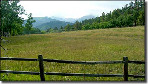 |
 Hinsdale County State Wildlife Areas Brown Lakes Lake Fork Gunnison River Mason Family Rito Hondo Reservoir Road Canyon Reservoir Williams Creek Reservoir |
|
Brown Lakes From Creede go 25 miles west on Highway 149 to USFS Road 515 (Hermit Lakes Road), then go 1.5 miles west to property. Lake Fork of the Gunnison River - fishing easements From Lake City go 5.3 miles north on Highway 149 to south end of easement. Mason Family Go 17 miles south from Powderhorn on CR 27 (Cebolla Creek Road). Rito Hondo Reservoir From Creede go 35 miles west on Highway 149 to USFS Road 513, then 2 miles northwest to the fork. Take right fork 200 yards north to reservoir. Road Canyon Reservoir From Creede go 25 miles west on Highway 149 to USFS Road 520, then 4 miles west to reservoir. Williams Creek Reservoir From Pagosa Springs go 3 miles west on US 160 to USFS Road 631, then 30 miles north to reservoir. |
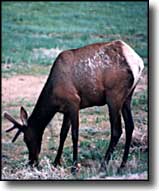
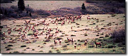 Elk in a meadow |
|
|
Hinsdale County Related Pages
Colorado Trust Lands & Wildlife Areas - GMU Map (.pdf)
State Trust Lands FAQ - Big Game Seasons (.pdf) Hinsdale County - The Colorado Fishing Story Colorado Pages
Towns & Places - Scenic Byways - State Parks - BLM Sites - History & Heritage Ski & Snowboard Areas - Photo Galleries - Colorado Mountains - Scenic Railroads Unique Natural Features - Wilderness Areas - Outdoor Sports & Recreation Colorado's National Forests - National Wildlife Refuges - Colorado's National Parks |

|
| Index - Arizona - Colorado - Idaho - Montana - Nevada - New Mexico - Utah - Wyoming National Forests - National Parks - Scenic Byways - Ski & Snowboard Areas - BLM Sites Wilderness Areas - National Wildlife Refuges - National Trails - Rural Life Advertise With Us - About This Site - Privacy Policy |
| Photos courtesy of Sangres.com, CCA ShareAlike 3.0 License. All text Copyright © by Sangres.com. All rights reserved. |