
Deep Creek Mountains Wilderness Study Area

The Deep Creek Mountains

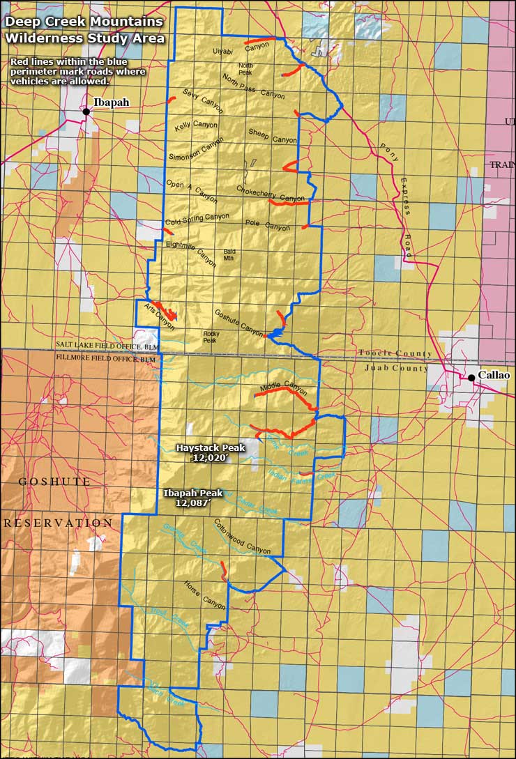
The 68,910-acre Deep Creek Mountains Wilderness Study Area is in western Utah, against the Goshute Tribal Lands and almost against the boundary with Nevada. With 2 peaks that rise above 12,000', the Deep Creek Mountains are the highest landmarks in western Utah. This is an "island" ecosystem with great biological wealth. Deep Creek Valley is to the west, the Great Salt Lake Desert to the east. The mountain range runs north-south for 32 miles but is only between 3 and 15 miles wide.
Surrounded by a barren, scrub-filled landscape of playa basins and alluvial outwash, the Deep Creeks rise sharply to alpine meadows fringed by aspen and evergreen forests. Junipers, Ponderosa and bristlecone pines, aspen... and among the numerous canyons cut into the granite and quartzite of the range you'll find 9 perennial streams.
Getting here is not easy. Wendover is 55 miles to the north. There are some serious backcountry roads around the mountains, one of them being the Pony Express National Historic Byway/National Back Country Byway, which runs east and north of the Wilderness Study Area. Vehicular access is allowed on certain designated roads in the WSA but, for the most part, the rules here are the same as for any other designated wilderness area: no mechanized or motorized vehicles allowed beyond those posted road closure signs.


