
Utah County, Utah

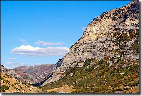
A scene in Utah Valley
Cities & Towns:
Alpine
American Fork
Cedar Fort
Cedar Hills
Draper
Eagle Mountain
Elk Ridge
Fairfield
Genola
Goshen
Highland
Lehi
Lindon
Mapleton
Orem
Payson
Pleasant Grove
Provo
Salem
Santaquin
Saratoga Springs
Spanish Fork
Springville
Vineyard
Woodland Hills
Alpine
American Fork
Cedar Fort
Cedar Hills
Draper
Eagle Mountain
Elk Ridge
Fairfield
Genola
Goshen
Highland
Lehi
Lindon
Mapleton
Orem
Payson
Pleasant Grove
Provo
Salem
Santaquin
Saratoga Springs
Spanish Fork
Springville
Vineyard
Woodland Hills
Utah County is in the heart of Utah with the eastern county line along the top ridgeline of the Wasatch Front. Mt. Timpanogos Wilderness, Timpanogos Cave National Monument and Sundance Ski Resort are here.
Utah County is often referred to as "the most Republican County in the most Republican state." Utah County contains 1,998 square miles of land and 143 square miles of water. The county seat is Provo.
Fast Facts about Utah County, Utah
Types of Jobs:
Private Sector, wages or salary: 82%
Government Sector: 12%
Unincorporated, Self-Employed: 6%
Population Density: 273 People per Square Mile
2011 Cost of Living Index for Utah County: 87.4
Median Resident Age: 23.3 Years
Private Sector, wages or salary: 82%
Government Sector: 12%
Unincorporated, Self-Employed: 6%
Population Density: 273 People per Square Mile
2011 Cost of Living Index for Utah County: 87.4
Median Resident Age: 23.3 Years
2009 Estimates:
Estimated Median Household Income: $57,700
Estimated Median Home Value: $238,800
Major Industries:
Educational Services, Professional Services, Health Care, Construction, Lodging & Food Services, Waste Management Services, Finance & Insurance Services, Retail Services
Estimated Median Household Income: $57,700
Estimated Median Home Value: $238,800
Major Industries:
Educational Services, Professional Services, Health Care, Construction, Lodging & Food Services, Waste Management Services, Finance & Insurance Services, Retail Services
Population Demographics: 2010
| Total Population | 516,564 |
| Males | 258,761 |
| Females | 257,803 |
| Population by Age | |
| Under 18 | 181,977 |
| 18 & over | 334,587 |
| 20-24 | 58,410 |
| 25-34 | 88,102 |
| 35-49 | 78,834 |
| 50-64 | 52,611 |
| 65 & over | 33,457 |
| Population by Ethnicity | |
| Hispanic or Latino | 55,793 |
| Non Hispanic or Latino | 460,771 |
| Population by Race | |
| White | 461,775 |
| African-American | 2,799 |
| Asian | 7,032 |
| Native American | 3,074 |
| Hawaiian or Pacific Islander | 3,905 |
| Other | 23,943 |
| Two or more | 14,036 |
