Manderson, Wyoming
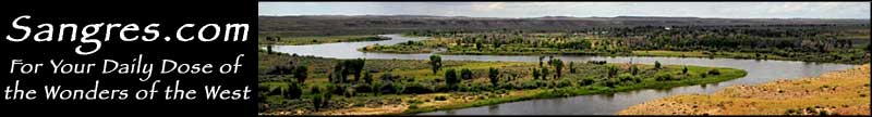
Manderson began its existence with the name "Alamo" but was renamed in 1889 in honor of the chief counsel of the Chicago, Burlington & Quincy Railroad, Charles Manderson. The railroad is what made the settlement of Manderson possible: it was the railroad's subsidiary Lincoln Land Company that surveyed and platted the town, then started selling lots. One thing the Lincoln Land Company did to improve the sale of lots in Manderson was to build a highway bridge over the Bighorn River at Manderson. The bridges at Manderson and Greybull are what made it practicable for people to drive to either Worland or Sheridan on shopping expeditions (even though the road wasn't paved until after 1936 when the Sheridan Highway was designated as an extension of US Highway 14).
Latitude: 44.2699°N
Longitude: 107.9623°W
Elevation: 3,891'
Education:
High School or Higher: 74.3%
Bachelor's Degree or Higher: 10.0%
2011 Cost of Living Index for Manderson: 81.3
Median Resident Age: 39.0 Years
Estimated Median Household Income: $21,520
Estimated Median Home Value: $44,140
Population Density: 122 People per Square Mile
Major Industries:
Oil & Gas Drilling, Construction, Educational Services, Government
Unemployed (March 2011): 8.6%
Population Demographics: 2010
| Total Population | 114 |
| Males | 56 |
| Females | 58 |
| Population by Age | |
| Under 18 | 27 |
| 18 & over | 87 |
| 20-24 | 4 |
| 25-34 | 7 |
| 35-49 | 22 |
| 50-64 | 30 |
| 65 & over | 23 |
| Population by Ethnicity | |
| Hispanic or Latino | 11 |
| Non Hispanic or Latino | 103 |
| Population by Race | |
| White | 108 |
| African-American | 0 |
| Asian | 0 |
| Native American | 0 |
| Hawaiian or Pacific Islander | 0 |
| Other | 3 |
| Two or more | 3 |
Greybull - Lovell - Big Horn County
Bighorn Canyon National Recreation Area - Bighorn National Forest
Bighorn Scenic Byway - Medicine Wheel Passage
Red Gulch-Alkali Back Country Byway
