Chiricahua Wilderness

In the Chiricahua Wilderness
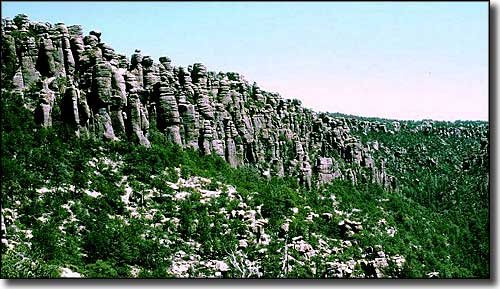
The 87,700-acre Chiricahua Wilderness used to be called home by the Chiricahua Apaches, back in the days of Cochise, Vittorio and Geronimo. The property is near Chiricahua National Monument, which contains some of the most spectacular and stark geology in the southwestern United States. Elevations vary from about 5,200' to the summit of Chiricahua Peak at 9,797'. Chiricahua Wilderness covers the inner canyons and upper slopes of the largest mountain range in the "Sky Island" region of southeastern Arizona.
The forest here is a wild mix of Chiricahua pine, Mexican white pine, Apache pine, white fir, Engelmann spruce, Douglas fir, aspen, pinon, juniper, oak and madrone. Under the trees you'll find mountain lion, black bear, coatimundi, mule deer, and javelina. The area also sees a lot of birds that are usually found only in Mexico and Central America.
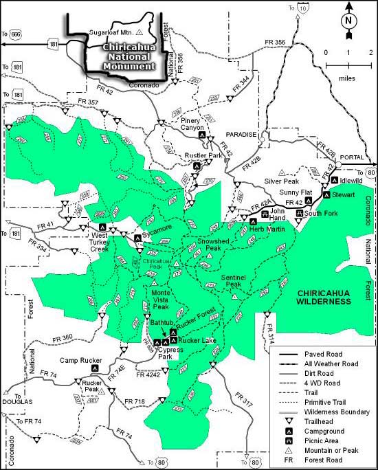
There are 13 established trails in the Chiricahua Wilderness, and because of the dense timber and undergrowth, vertical canyon walls and steep hillsides, most folks stick to the trails. There is usually water in some of the canyons and at springs along the crest year-round but in some years the water supply in this area is undependable. Be prepared and carry lots of your own. Easy access to Chiricahua Wilderness is available at trailheads in Turkey Creek, Cave Creek and Rucker Canyon. The Morse Canyon Trail also rewards hikers with great views over what is probably the roughest terrain in southeastern Arizona. Another favorite is the Crest Trail which follows the highest ridges across the Wilderness. However, there are still fire-killed trees falling in the aftermath of a large wildfire that swept through Chiricahua Wilderness in the mid-1990's. These fallen trees often block the trails and can make the going kinda hard. You'll want to be careful in these areas when there's a good breeze blowing, too.
USGS Quads: Stanford Canyon, Swede Peak, Portal Peak, Fife Peak, Portal, Rustler Park, Chiricahua Peak

Chiricahua Wilderness map
