Galiuro Wilderness

Galiuro Wilderness
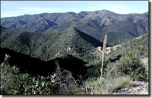
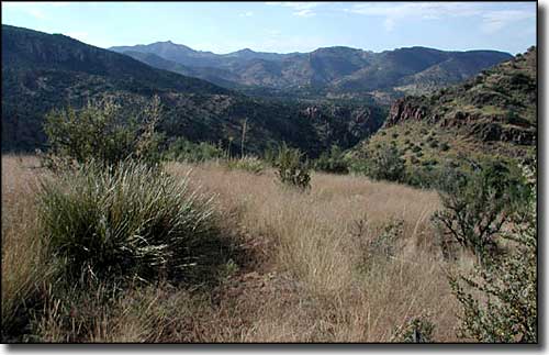
The Galiuro Mountains are a fault-block uplift range about 19 miles long and about 6 miles wide, rising almost straight up from the flat desert plain that surrounds the mountains. The mid to upper slopes of the mountain range are included in the 76,317-acre wilderness. The Galiuro Wilderness is an area of eroded but rugged cliffs with exposed soils and brightly colored rock. Elevations range from a low of about 4,000' to the top of Bassett Peak at 7,671'. The Wilderness is bisected by Redfield and Rattlesnake Canyons, two deep and narrow eroded cuts into the ancient blocks of granite that make up these mountains. The lower reaches of Redfield Canyon are in the Redfield Canyon Wilderness.
Starting at the bottom of the hill, the vegetation runs from desert grasslands through the pinon, juniper and oak zone into mixed conifers and aspens near the tops of the ridges. There are no perennial streams in these mountains but there are several springs that flow nearly all year round and support small riparian areas throughout the Wilderness. The springs also support black bears, deer, javelinas, mountain lions, bobcats, pronghorns, coyotes, and desert bighorn sheep. This was also Mexican wolf habitat up until the mid-1950's (and may again be if the federal Fish & Wildlife Service lets them loose in here, as they have in the Bear Wallow and Escudilla Wildernesses to the northeast).
Near the top of Bassett Peak you'll find the wreckage of a B-24 bomber that crashed here in January, 1943. There is a plaque on one of the wings that commemorates the 11 men who died on board. Something not commemorated often was a famous old west shoot-out that happened at Power Cabin in Rattlesnake Canyon in the heart of the mountains back in 1918. Tom and John Power, two of Jeff Power's sons, had been drafted to fight in World War I but they failed to report for induction (report for induction? they hadn't even registered for the draft in the first place). The Graham County Sheriff delivered a letter to them asking that they come to town and surrender for prosecution, but the letter was ignored. Then, on the night of February 9, 1918, the sheriff, 2 deputy sheriffs and a US Marshall arrived at the cabin with enough warrants to arrest everyone on the property. Just before dawn, Jeff Power emerged from the cabin to see what was spooking his horses and one deputy sheriff yelled at him to put up his hands. When the shooting stopped, the sheriff, the 2 deputy sheriffs and Jeff Power were dead. The US Marshal ran away through the woods and made his way to Klondyke at the foot of the mountains. The 2 Power boys and the hired hand (Tom Sisson) escaped east, eventually crossing the border into Mexico near Hachita, New Mexico. On March 8, they surrendered to a US Army patrol that had followed them into Mexico. At the trial all three were convicted of first degree murder and sentenced to life in prison. Tom Sisson died there but the 2 brothers were paroled in 1960, after serving 42 years. 9 years later, they were pardoned by the governor of Arizona.
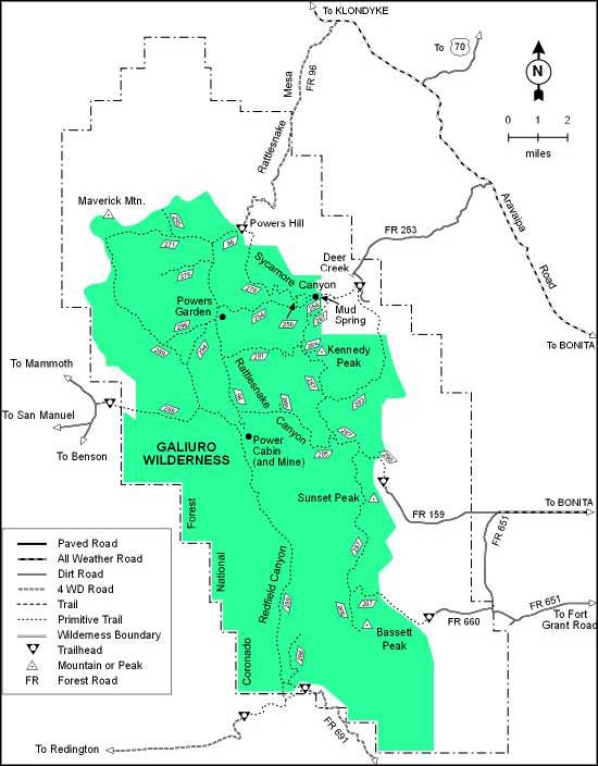
Most folks access Galiuro Wilderness via the Deer Creek Trailhead at the end of FR 253, via the Powers Garden Trail #96 from the Aravaipa Canyon Road or from the end of FR 691 at the Redfield Canyon Trailhead. There are a number of trails in the wilderness but most of them are poorly marked and even less maintained. The busiest trails across the Wilderness (East Divide #287 and West Divide #289) run along the tops of twin ridges that cross the area from northeast to southwest. These 2 trails give access to nearly every other trail and spur out here. The slightly less busy Rattlesnake Canyon and Redfield Canyon Trails also cross Galiuro Wilderness but through the lower reaches of those canyons. You'll want to bring plenty of water (because what is here is unreliable), a good map, a compass (maybe a GPS device), and a pair of top notch hiking boots: the topography here makes off-trail hiking almost impossible and the trails themselves aren't much better.
USGS Quads: Kielberg Canyon, Winchester Mountains, Rhodes Peak, Kennedy Peak, Harrison Canyon, Cherry Spring, Bassett Peak.
GPS Location: 32.586667°N Latitude, -110.33°W Longitude

Galiuro Wilderness

Galiuro Wilderness map

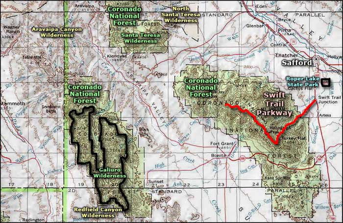
Galiuro Wilderness area map
