 |
Gold Rush Historic Byway |
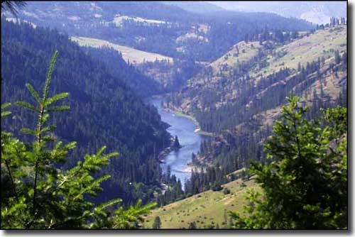 View from the top of Greer Grade on the Gold Rush Historic Byway |
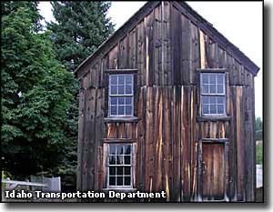
The Gold Rush Historic Byway runs along Idaho Highway 11 from Greer to Headquarters, a 42.5-mile paved route. After turning at Greer and heading east up the steep, switchbacked Greer Grade from the Northwest Passage Scenic Byway, you'll emerge on the Weippe Prairie. It was on the Weippe Prairie (near what is now the town of Weippe) that Lewis & Clark's Corps of Discovery were found in 1805 and fed by members of the Nez Perce tribe. The Lewis & Clark group had had a bad winter trying to get across Idaho and were essentially starving by the time they were found (and saved) by the Nez Perce. There's now a Discovery Center in Wieppe that commemorates this fateful meeting with displays and exhibits about the Nez Perce and about the Lewis & Clark Expedition. The Discovery Center also houses the Wieppe Library, Technology Center, a Small Business Development office, a College Outreach office and a Conference/Meeting area with kitchen facilities and public restrooms. Today, this is a big wheat, grain and hay growing area, but just past Weippe the scenery changes to lush forest and you enter into the original Gold Rush area of Idaho. The very first gold strike in the state was along Orofino Creek near the town of Pierce (named for Captain E.D. Pierce, leader of the gold prospectors). In Pierce is what remains of Idaho's inaugural government building: the former Shoshone County Courthouse. There's also a logging museum in Pierce and the Pierce town library has several artifacts and exhibits about the Chinese who used to live here (from 1865 to 1870, Chinese miners and businessmen made up almost 80% of the population in Pierce but the 1887 Idaho Supreme Court ruling that stated Chinese could not own or lease mining claims caused most of them to leave Idaho). The end of the byway is another 12 miles north of Pierce at Headquarters, gateway to the hinterlands of the Clearwater National Forest. Headquarters was the end of the railway line that ran through Pierce. It was that railway line that allowed the Potlatch Lumber Corporation to bring in a community of loggers (and their families) to work the vast timber resources of the North Fork of the Clearwater River. Idaho 11 is well maintained but can be snowy in the winter. Winter also brings access to more than 350 miles of groomed and open snowmobile trails. Between Pierce and Headquarters is the Bald Mountain Ski Area, a family-oriented, weekends-only, T-Bar and rope tow set-up on 140 acres that was originally built by Potlatch but is now operated by the Clearwater Ski Club. Also between Pierce and Headquarters is Deer Creek Reservoir, an 80-acre reservoir constructed by Potlatch Corporation and the Idaho Department of Fish and Game. The reservoir is stocked with cutthroat and rainbow trout but vehicular access is limited to that time period between May 20 and September 30. The rest of the year, folks just have to walk in (it's allowed). A trunk railroad line was built from Orofino to Headquarters in 1928. From there, a network of short spur lines spread out into the vast timber stands in the forests to bring cut timber back to town and deliver it to the company mills in Orofino. Today, Potlatch still has forest managers working from Headquarters, overseeing thousands of acres of forest that continue to provide the raw materials the mills need. The other main business in Headquarters these days revolves around recreational pursuits. About 1.5 miles beyond Headquarters along one of the small county roads you'll find Campbell's Pond. The pond supports a native population of bass and sunfish but Idaho Fish & Game visits every spring and drops off a truckload of locally-grown young rainbow trout, too. The recreation area offers camping, floating docks, picnic tables and vault toilets. |
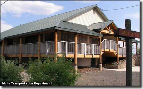 Weippe Discovery Center 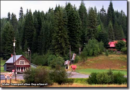 The Town of Headquarters 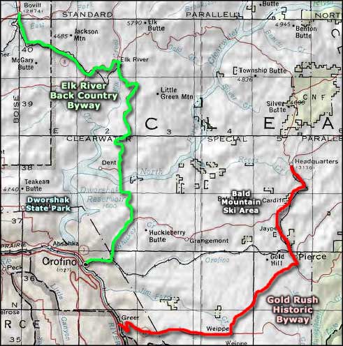 Gold Rush Historic Byway area map |
|
|
 |
| Index - Arizona - Colorado - Idaho - Montana - Nevada - New Mexico - Utah - Wyoming National Forests - National Parks - Scenic Byways - Ski & Snowboard Areas - BLM Sites Wilderness Areas - National Wildlife Refuges - National Trails - Rural Life Advertise With Us - About This Site - Privacy Policy |
|
Upper photo courtesy of Byways.org. Other photos courtesy of the Idaho Transportation Department. Area map courtesy of National Geographic Topo! Text Copyright © by Sangres.com. All rights reserved. |