 |
Western Heritage Historic Byway |
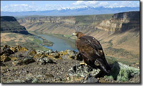 A golden eagle on the rim of the Snake River Gorge, above Swan Falls |
The Western Heritage Historic Byway runs a north-south route between Interstate 84 at Meridian and Swan Falls, a location about 40 miles to the south on the Snake River. Along the way, the route passes through the town of Kuna, then past the Pioneer Cemetery before coming to the entrance gate to the Snake River Birds of Prey National Conservation Area. Maybe 35 miles from Meridian you'll come to the overlook at Dedication Point and get a great view up and down the Snake River Gorge. A few more miles will bring you to the Three Pole Overlook, then Swan Falls. Down in the canyon below Swan Falls is the Swan Falls Dam, a structure that was built back when the nearby ghost mining camp at Silver City decided they wanted electricity. Swan Falls Dam is operated now by the Idaho Power Company and is still producing hydroelectric power for the people on the Snake River Plateau. In 1978 the dam was listed on the National Register of Historic Places. 
The first half of the Western Heritage Historic Byway follows old Indian trails that became freight and stagecoach routes after gold and silver were discovered in the Owyhee Mountains in 1863. Back then, the route linked Idaho City with Silver City (Boise was just barely getting established as a settlement). The route was known for many years as the Silver Trail. Just south of Kuna, the countryside changes from the fertile green of irrigated croplands to the rugged desertic landscape that has been here for thousands of years. Most of this scenic byway is on the Snake River Birds of Prey National Conservation Area and along the northern rim of the Snake River Gorge. This is an area of historic sites and sculpted, dramatic landscapes with the snow-capped Owyhee Mountains dominating the western horizons. This is also where you'll find the densest population of breeding raptors in North America with 16 different species nesting here every year and another 9 species visiting on their way through during migration seasons. You might also see see herds of wild mustangs in this area. Along the rim of Snake River Canyon are several pullouts with observation platforms at Dedication Point and the Snake River Canyon Overlook. 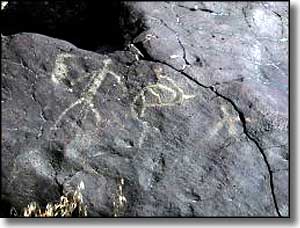
At Celebration Park you can stop and visit with rock art that was etched in the stone some 12,000 years ago. You can also get practice throwing an atlatl, and instruction if you need it. You can also take a hike through a boulder field strewn here by the waters of the ancient Bonneville Flood, or you can hike down the hill to Halverson Lake on the Snake River. There are 12 sites along the route of the Western Heritage Historic Byway where there are pullouts and interpretive signage about the geology, birds of prey, history and culture. Some of these pullouts also serve as trailheads, while others are there just so you can pause and admire the views. Inside the gate of the Snake River Birds of Prey NCA is a 1-mile long gravel road that leads to "Initial Point," a butte that was used by the surveyors of Idaho back in 1867 as the starting point of all government surveys done in the state. They marked the exact spot on top of the butte with a large brass marker. If you make the stop and hike the hill, you'll be rewarded with incredible views over the area: south to the Owyhees and north to the Boise Front. The Western Heritage Historic Byway is open year round but the last mile to Swan Falls Dam is steep, down the side of the Snake River Canyon, an area that often sees patches of ice in the winter. |
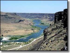
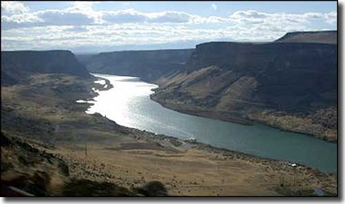 Another view of the Snake River Gorge 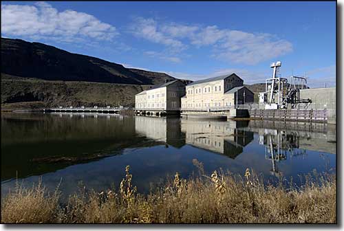 Swan Falls Dam on the Snake River 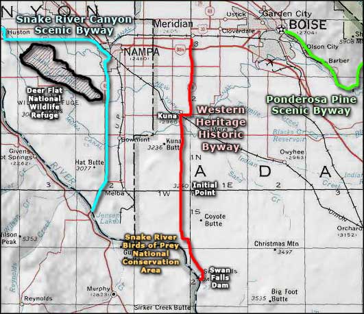 Western Heritage Historic Byway area map |
|
|
 |
| Index - Arizona - Colorado - Idaho - Montana - Nevada - New Mexico - Utah - Wyoming National Forests - National Parks - Scenic Byways - Ski & Snowboard Areas - BLM Sites Wilderness Areas - National Wildlife Refuges - National Trails - Rural Life Advertise With Us - About This Site - Privacy Policy |
| Photo of the golden eagle above the Snake River Gorge courtesy of Aldis Garsvo, Byways.org Photo of the Snake River Canyon is courtesy of Larry Ridenhour, Byways.org Smaller photos are courtesy of the Bureau of Land Management Area map courtesy of National Geographic Topo! Text Copyright © by Sangres.com. All rights reserved. |