 |
Rattlesnake Wilderness
|
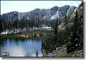
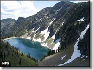
The Rattlesnake Wilderness is part of the Rattlesnake National Recreation Area and Wilderness, which begins just 4 miles north of Missoula, Montana. The 32,976 acres of actual wilderness lie to the north of and adjacent to the Rattlesnake National Recreation Area. The National Recreation Area sees heavy human use but the vast portion of that use is only within 3 miles of the main trailhead along a trail that leads along Rattlesnake Creek in a cherry-stem NRA corridor. 3 miles in there's another trail leading north across the Rattlesnake Wilderness boundary to reach a small cluster of high alpine lakes. Elevations vary from a low of about 3,600' at the main trailhead to a high of 8,620' at the top of McLeod Peak. |
Most of the Rattlesnake Wilderness is within the Northern Continental Divide Grizzly Bear Recovery Area, so you'll find grizzly bear, black bear, mountain lion, deer, elk, moose, wolverine, coyote, mountain goat, grey wolf and bighorn sheep. If you're going to hang around here for any amount of time, bear-proof storage is required everywhere in the Rattlesnake National Recreation Area and Wilderness. The South Fork Jocko Tribal Primitive Area abuts the northern boundary of the Rattlesnake Wilderness. That side of the boundary is sacred land to them so if you aren't a tribal member (and/or don't have a permit from the tribe), don't go there. |
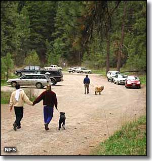
8 different trailheads give access to the Rattlesnake National Recreation Area and Wilderness. Camping and campfires are allowed in the Rattlesnake Wilderness itself but are restricted in the recreation area. The City of Missoula claims the Rattlesnake Creek drainage as a municipal watershed and several lakes in the wilderness are dammed and maintained by the water utility. These lakes and the trails that lead to them are closed to livestock and allow only human access. These are areas where you don't want to be camping either. |
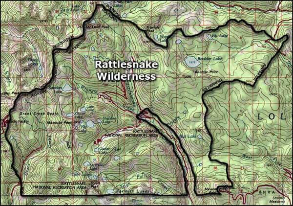 Map of the Rattlesnake Wilderness area |
|
|
 |
| Index - Arizona - Colorado - Idaho - Montana - Nevada - New Mexico - Utah - Wyoming National Forests - National Parks - Scenic Byways - Ski & Snowboard Areas - BLM Sites Wilderness Areas - National Wildlife Refuges - National Trails - Rural Life Advertise With Us - About This Site - Privacy Policy |
| Photos of the Rattlesnake National Recreation Area & Wilderness are courtesy of the National Forest Service Map courtesy of National Geographic Topo! Text Copyright © by Sangres.com. All rights reserved. |