 |
UL Bend Wilderness |
 In the UL Bend Wilderness |
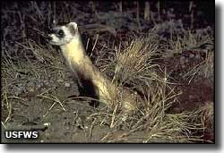
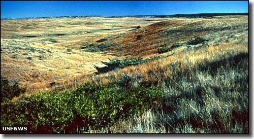
The Charles M. Russell National Wildlife Refuge runs upstream on the Missouri River for about 125 miles from the Fort Peck Dam, and covers about 1,000,000 acres. Within the Charles M. Russell National Wildlife Refuge is the UL Bend National Wildlife Refuge, and within that is the 20,819 acres of the UL Bend Wilderness. This is a remote area that has probably seen more T Rex than humans, although the Lewis and Clark Expedition did paddle through here a bit more than 200 years ago (and they wrote a lot about the ruggedness of the countryside and the abundance of wildlife). And these days, the Missouri is a designated Wild and Scenic River to the west of here and carries quite a few canoers, kayakers and rafters through the area. UL Bend Wilderness itself is broken into 4 units, 3 small and 1 large, all on the north side of the river) and mostly along the shore. The area is primarily sagebrush and open grassland with no maintained trails, but hiking, camping and horseback riding are allowed and unrestricted (certified weed-free hay for the horses, please). Hunting and fishing are allowed in season, too. The UL Bend Wilderness was selected in the 1990's as a good area to reintroduce the most endangered mammal in North America: Black-footed ferrets. One reason for the choice is the large number of prairie dogs running around here: Black-footed ferrets are carnivorous and prairie dogs are their favorite lunch. |
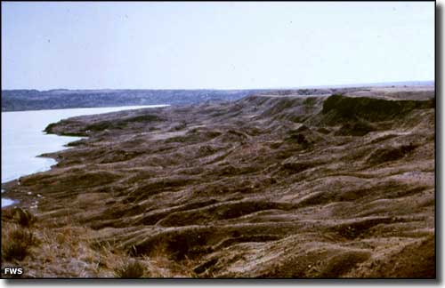 Along the Missouri River in UL Bend Wilderness 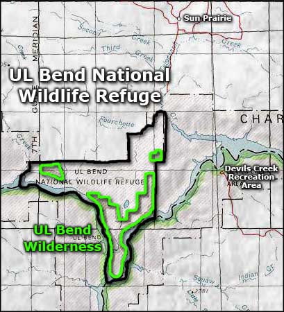 Area map of the UL Bend Wilderness |
|
|
 |
| Index - Arizona - Colorado - Idaho - Montana - Nevada - New Mexico - Utah - Wyoming National Forests - National Parks - Scenic Byways - Ski & Snowboard Areas - BLM Sites Wilderness Areas - National Wildlife Refuges - National Trails - Rural Life Advertise With Us - About This Site - Privacy Policy |
| Photos of the UL Bend Wilderness and the Black-footed ferret courtesy of the US Fish & Wildlife Service Map courtesy of National Geographic Topo! Text Copyright © by Sangres.com. All rights reserved. |