 |
Mount Rose Highway |
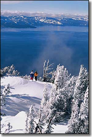
South of Reno, State Route 431 heads west from US 395 and climbs the shoulder of Mt. Rose to cross the highest (8,911') all-season pass in the Sierra Nevada's before dropping into Tahoe Basin and ending in Incline Village at Route 28. The views of the lake are simply breathtaking (I think the photo to the left says it all). The 22.2-mile Mt. Rose Highway is open year-round except for occasional winter weather closures. The Mount Rose Scenic Byway offers access to the Tahoe Rim Trail and to the 28,000 acres of the Mt. Rose Wilderness. Mt. Rose Ski Area, Galena Creek County Park and a Forest Service campground directly at the summit are up here, too. |
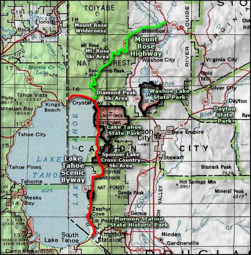 Mount Rose Highway area map |
|
|

|
| Index - Arizona - Colorado - Idaho - Montana - Nevada - New Mexico - Utah - Wyoming National Forests - National Parks - Scenic Byways - Ski & Snowboard Areas - BLM Sites Wilderness Areas - National Wildlife Refuges - National Trails - Rural Life Advertise With Us - About This Site - Privacy Policy |
| Area map courtesy of National Geographic Topo! Text Copyright © by Sangres.com. All rights reserved. |