
Walnut Canyon National Monument

Walnut Canyon
Walnut Canyon is a 20-mile long canyon carved into the rock of the Colorado Plateau over the last 60 million-or-so years by seasonal water flowing in Walnut Creek. About 8 miles of the canyon are included in the National Monument. At the west end of the monument, the canyon is about 400' deep, at the east end it's about 250' deep. Through the park, the average width of the canyon is 1/4 mile.
Located about 10 miles southeast of downtown Flagstaff, Walnut Canyon is an oasis for an abundant mix of animals and plants drawn by the water and the protection offered by the topography. And from about 1100 AD to about 1250 AD, the canyon was home to 100 or more people of the Sinagua culture. They left several masonry structures in shallow alcoves along the limestone ledges in the upper part of the canyon walls for us to remember them by. A 0.9 mile loop trails drops about 185' into the canyon and passes by about 25 rooms constructed in the cliffs. The trail is situated to pass directly below nearly every Sinagaua structure in this part of Walnut Canyon but there are many more dwellings just east of the boundary of the National Monument where it is illegal for the public to enter.

One of the cliff dwellings in Walnut Canyon

The North Wall of Walnut Canyon
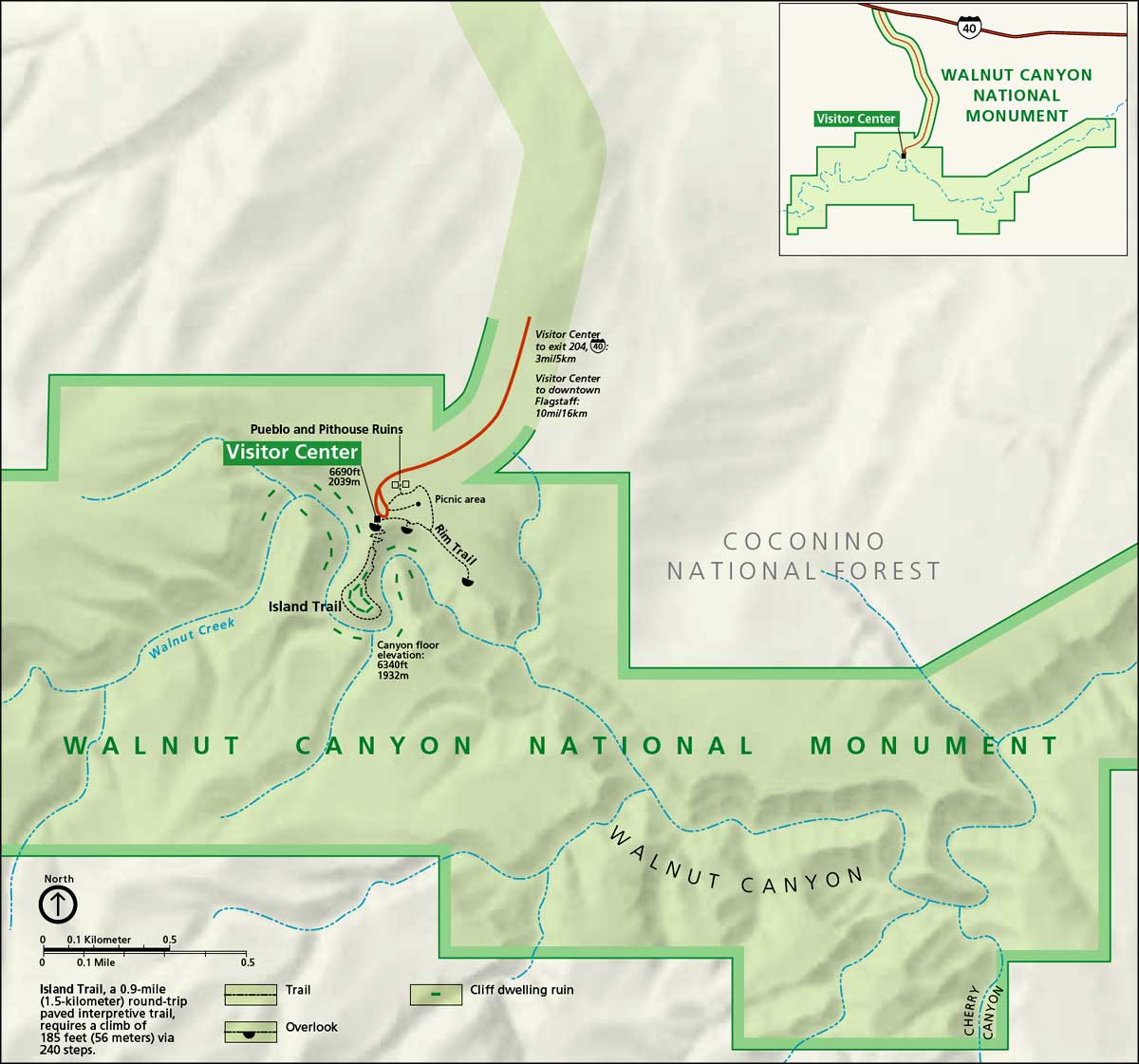
Click on the map for a larger version

Walnut Canyon National Monument area map
