Archuleta County, Colorado

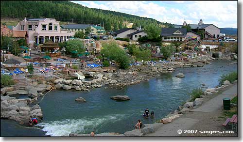
The Hot Springs area along the San Juan River in Pagosa Springs
Archuleta County is located on the western side of the Continental Divide in south western Colorado, against the New Mexico border. The county seat is Pagosa Springs, a town which has seen tremendous growth over the last few years, although some 60% of the homes are owned by non-residents. Archuleta County contains 1,350 square miles of land and 5 square miles of water.
Originally, Archuleta County was part of Conejos County, one of the 17 original counties in Colorado. On April 14, 1885, the Colorado legislature created Archuleta County out of the western part of Conejos County and named it for J.M. Archuleta, patriarch of one of the old Spanish families of New Mexico, and in honor of Antonio D. Archuleta, the Senator from Conejos County at that time.
A large part of Archuleta County is owned by the Federal Government as part of the San Juan National Forest. Another big chunk of the county is part of the Southern Ute Indian Reservation.

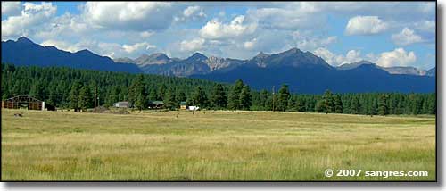
A typical view in Archuleta County
Private Sector, wages or salary: 61%
Government Sector: 17%
Unincorporated, Self-Employed: 21%
Homemaker, Unpaid: 1%
Population Density: 9 People per Square Mile
2011 Cost of Living Index for Archuleta County: 92.1
Median Resident Age: 40.8 Years
Estimated Median Household Income: $44,506
Estimated Median Home Value: $237,978
Major Industries:
Lodging & Food Services, Construction, Educational Services, Real Estate Services, Government, Health Care, Professional Services, Repair & Maintenance, Finance & Insurance Services
Population Demographics: 2010
| Total Population | 12,084 |
| Males | 6,103 |
| Females | 5,981 |
| Population by Age | |
| Under 18 | 2,408 |
| 18 & over | 9,676 |
| 20-24 | 456 |
| 25-34 | 1,115 |
| 35-49 | 2,189 |
| 50-64 | 3,581 |
| 65 & over | 2,116 |
| Population by Ethnicity | |
| Hispanic or Latino | 2,148 |
| Non Hispanic or Latino | 9,936 |
| Population by Race | |
| White | 10,436 |
| African-American | 37 |
| Asian | 89 |
| Native American | 227 |
| Hawaiian or Pacific Islander | 6 |
| Other | 948 |
| Two or more | 341 |
Navajo State Park - Wolf Creek Ski Area
Mountains
San Juan Mountains - Wolf Creek Pass
National Park Service Sites - BLM Sites - National Wilderness Areas - Unique Natural Features
Outdoor Sports & Recreation - Ski & Snowboard Areas - Photo Galleries - Colorado Mountains
