 |
Wolf Creek Pass |
|
|
 Heading up out of South Fork |
|
|
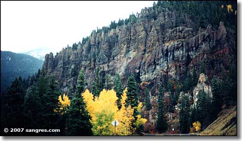
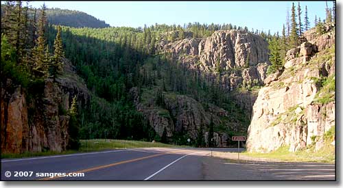
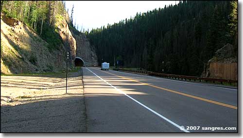
Wolf Creek Pass, in the San Juan Mountains, is an adventure. When the first pioneers came through, the pass took two to three weeks to cross. Every spring the trail had to be remade. By the time the automobile came along, the trail was in pretty good shape but those first cars still took two days to a week to cross the 42 miles from South Fork to Pagosa Springs. The road leaves South Fork following the channel cut in the granite by the South Fork of the Rio Grande. The canyon here was also modified by glacial action in the last Ice Age. Lots of exposed rock faces. There is also a lot of river and pond along the road, most of it accessible for fishing purposes. 2007: For several years, the road through the pass has been under construction while CDOT was digging a tunnel and widening the road between South Fork and the summit. Well, the work is finally done and the pass is that much easier to cross. January 31, 2008: I went up to Wolf Creek Ski Area (great skiing day) and got some photos along the way. As I went up, the snowbanks along the road got higher and higher, finally topping 8 feet just below the ski area. The road was mostly snow-packed and icy but traffic was light. And CDOT seems to keep a crew in the area just to keep the pass open: snow plows are one thing but these guys use some big snow throwers to get the stuff back from the roadway. |
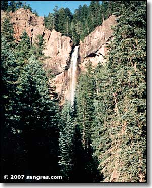
It's a pretty long climb up the hill but the scenery just gets better and better. Just before the top is the Wolf Creek Ski Area. The Ski Area is famous for "The Most Snow in Colorado." The top of the pass is at 10,850 feet. There is a rest area there and a sign commemorating the Continental Divide. The Continental Divide National Scenic Trail crosses the road here and follows the ridges north and south. The western side isn't any steeper than the eastern side but it has a couple of good switchbacks in it. At the top of the first one is a pull-over for a scenic overlook. Make the stop, take some pictures. The view is incredible. A little further down the hill to the west is Treasure Falls. This is a beautiful 100 foot waterfall that flows most of the year. The hike to the foot of the falls isn't bad but it can be slippery in spots when the spring runoff is high. (That's a photo of Treasure Falls to the right) As you come to the bottom of the hill, you are entering the San Juan River Valley. The road then takes you straight into Pagosa Springs. Fall 2006: I hear that Red McCombs has gotten approval to build his road through forest service land and begin construction on his high-density subdivision right near the bottom of the ski slopes at the top of the pass. Every normal Colorado citizen (and his dog) fought against this one but our federal government treats billionaires a bit differently than the rest of us. In the end, Mr. McCombs has proved once again that while federal government agencies supposedly aren't for sale, they (and/or their administrators) can be bought (according to the Denver Post anyway - let's see whose lawyers I hear from for this comment). |
|
Update: On February 19, 2008, after 16 months of heavy duty legal wrangling, the Friends of Wolf Creek finally got an order from a Federal Judge requiring that the developers and the Forest Service do a real, honest Environmental Impact Statement in regards to the proposed 10,000-person "Village" at Wolf Creek Pass, before they do any more damage to the area. For the moment, their end run around the environmental protection laws has failed and the development is stopped dead while a fair and unbiased EIS is prepared (let's hope this one really is fair and unbiased - the last one seems to have been tainted by offers of bonuses and penalties from the developer to the EIS contractor). In the meantime, I want to say "Congratulations Friends of Wolf Creek, you've fought a hard one for all of us who love the outdoors and the forest just the way they are. Thank you." Click the link for the Friends of Wolf Creek and you'll find some pretty interesting reading regarding how some National Forest Service and Mineral County administrators and the Leavell-McCombs Joint Venture (the developers) carry on their business. When you're finished you'll realize that this really is still "the Real Wild West." |
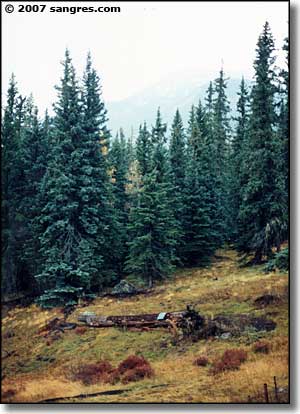
  Heading into a tunnel (near Big Meadows turn-off) 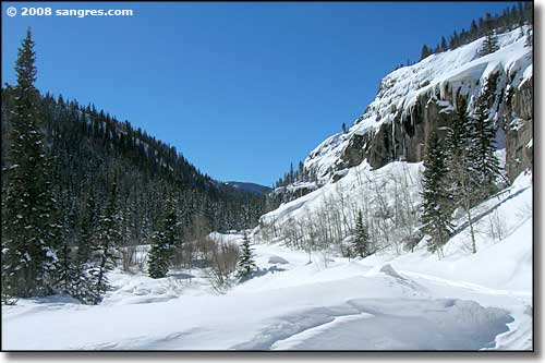 Big Meadows turn-off in January 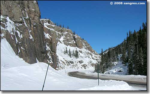 At Big Meadows turn-off in January 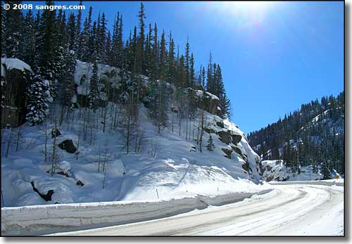 At Big Meadows turn-off in January 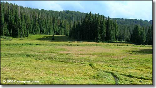 At the top of the Pass 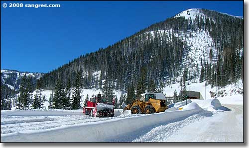 January, just east of the snow shed (the ski area is on the far left of the photo) 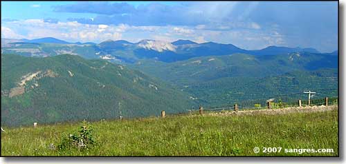 Looking south from Lobo Overlook 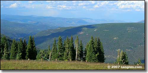 Looking northeast from Lobo Overlook 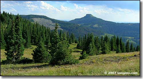 Looking southwest from Lobo Overlook 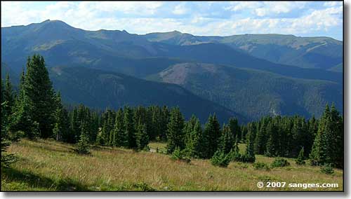 Looking north from Lobo Overlook 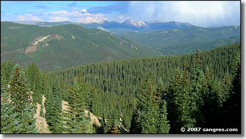 Looking south from Lobo Overlook 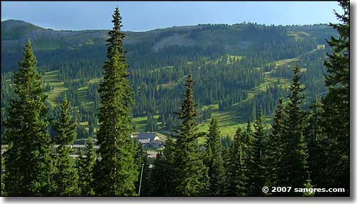 Wolf Creek Ski Area 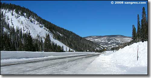 Just below Wolf Creek Ski Area in January 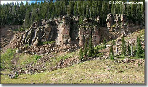 Granite Outcropping 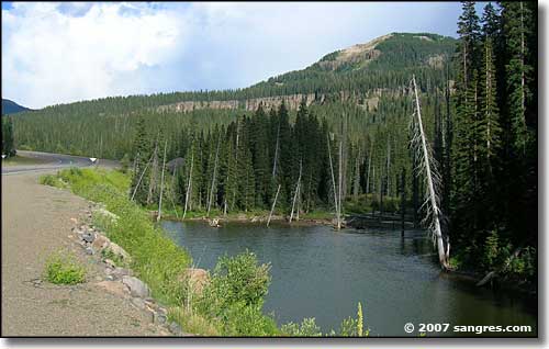 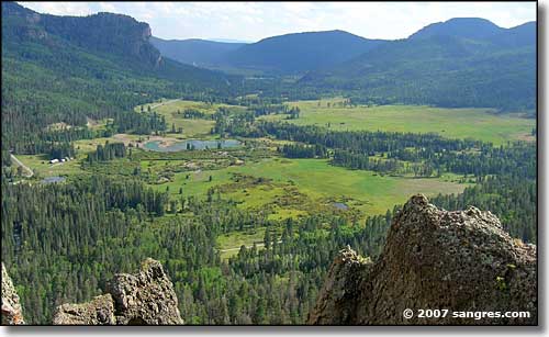 Looking down from the Overlook on the south side of the Pass 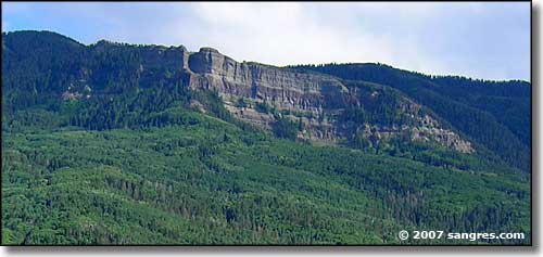 Looking southwest from the Overlook 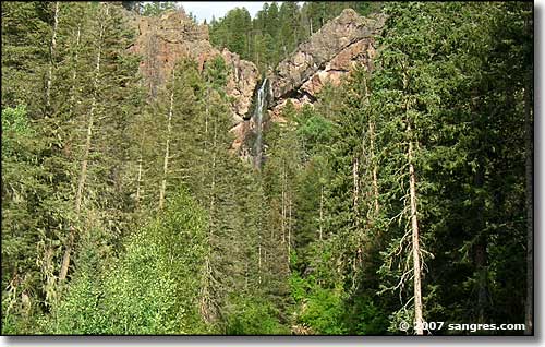 Another shot of Treasure Falls 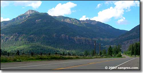 Just out of the mountains on the Pagosa Springs side 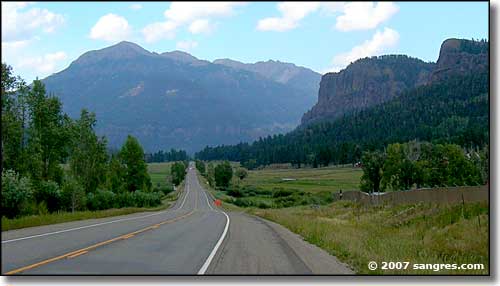 Looking northeast just out of Pagosa Springs |
|
|
Wolf Creek Pass Related Pages
Archuleta County - Mineral County - Rio Grande County
San Juan National Forest - Rio Grande National Forest - Wolf Creek Ski Area Colorado Pages
Towns & Places - Scenic Byways - State Parks - BLM Sites - History & Heritage
Ski & Snowboard Areas - Photo Galleries - Colorado Mountains - Scenic Railroads Unique Natural Features - Wilderness Areas - Outdoor Sports & Recreation Colorado's National Forests - National Wildlife Refuges - Colorado's National Parks |
 |
| Index - Arizona - Colorado - Idaho - Montana - Nevada - New Mexico - Utah - Wyoming National Forests - National Parks - Scenic Byways - Ski & Snowboard Areas - BLM Sites Wilderness Areas - National Wildlife Refuges - National Trails - Rural Life Sponsor Sangres.com - About Sangres.com - Privacy Policy - Accessibility |
| Photos courtesy of Sangres.com, CCA ShareAlike 3.0 License. Text Copyright © by Sangres.com. All rights reserved. |