Uncompahgre Wilderness

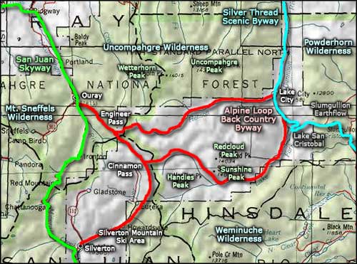
The Uncompahgre Wilderness spans more than 99,000 acres of the Uncompahgre National Forest and 3,400 additional acres on lands administered by the BLM. Elevations vary from 8,400' to 14,309' feet. There's about 110 miles of foot and horse trails in this Wilderness. Trailheads are located in the West, Middle, and East Forks of the Big Cimarron River. The Big Blue Trail, beginning south of the Big Blue Campground, is also a well-traveled route into the Wilderness. Additional trails enter the wilderness from near the towns of Ouray and Lake City.
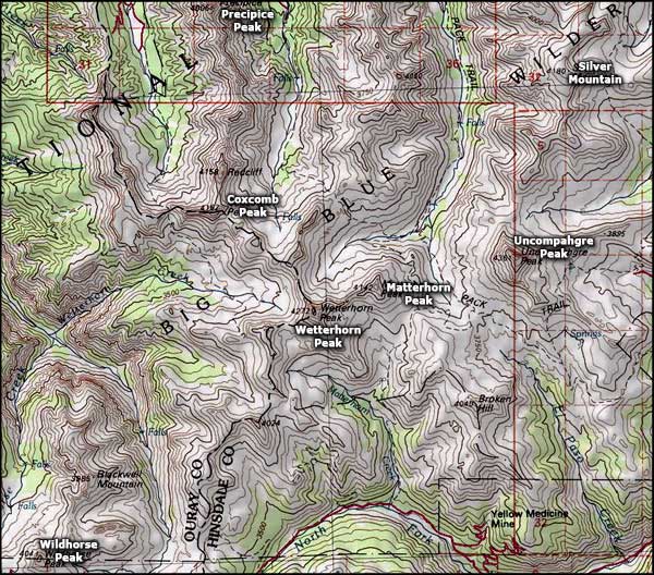
While the lower parts of the Uncompahgre Wilderness may be snow free early in June, normal snow-free conditions run from mid-July to early September, but conditions can vary considerably from year to year. Points of interest include: Uncompahgre Peak (14,309 ft); Wetterhorn Peak (14,015 ft); Matterhorn Peak, Coxcomb Peak, Silver Peak, Slide Lake, and Big Blue Creek.
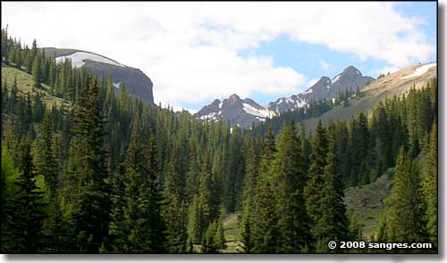
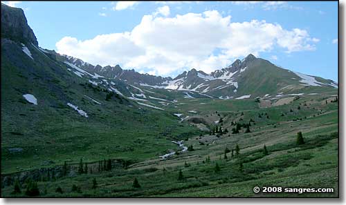
Uncompahgre Wilderness is a rugged, mountainous countryside of sweeping, gendarme-strewn ridges and towering rock castles. As you hike your way up the hill along the creek beds in here, you'll be going through some of the finest mountain scenery on Earth. And several of the high peaks in here offer numerous challenges for the technically inclined.
Trails to the 14,000' peaks in this wilderness and most other wildernesses are heavily used. You will most likely not find any peace and quiet on them, especially on summer weekends. High use of these trails creates a heavy impact on fragile landscapes. If you are looking for a more solitary wilderness experience, you would more likely find it in less popular areas of the wilderness.


Uncompahgre Wilderness map

Uncompahgre Wilderness area map
Weminuche Wilderness - Mount Sneffels Wilderness - Powderhorn Wilderness
Silverton Mountain Ski Area - Lake San Cristobal - Slumgullion Pass and Earthflow
National Park Service Sites - BLM Sites - National Wilderness Areas - Unique Natural Features
Outdoor Sports & Recreation - Ski & Snowboard Areas - Photo Galleries - Colorado Mountains
