 |
Lake Couer d'Alene Scenic Byway |
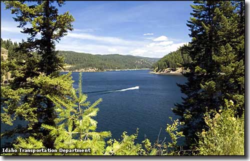 Lake Couer d'Alene from near Beauty Creek |
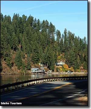
The Lake Couer d'Alene Scenic Byway travels along the eastern shore of Lake Couer d'Alene for about 36 miles. The northern end is at the junction of Idaho Highway 97 with Interstate 90, the southern end is at the junction of Idaho 97 and Idaho Highway 3 (the White Pine Scenic Byway). Lake Couer d'Alene is a large, beautiful blue lake that also supports one of the largest populations of nesting osprey in the western states. If you're wanting to see bald eagles, best time is December and January, between Beauty Bay and Wolf Lodge Bay. At any time of year you might come across elk, moose, mule deer, white-tailed deer and black bear, especially around sunrise and sunset near the water. At Wolf Lodge Bay you'll find the 3.3-mile Mineral Ridge Interpretive Trail, a nice hike on a hill that offers some great views overlooking the lake along with several learning stations describing the area's animal life, vegetation and other aspects of the local ecosystem. Around the lake you'll also find a couple of botanical research stations and the Thompson Lake Wildlife Refuge: a wetlands area managed by Idaho Fish & Game for the benefit of the many osprey who nest in the area. Thompson Lake offers a seven-mile loop road with interpretive sites and a bird blind for viewing and photographic purposes. At Mineral Ridge is a 3.3-mile self-guided interpretive loop trail which is also a designated National Recreation Trail. The loop offers spectacular views of Wolf Lodge Bay and Lake Couer d'Alene while it also allows you to get up-close-and-personal with the native plant and animal communities. The Beauty Creek Recreation Area offers camping, picnicking and hiking trails 3/4 of a mile south of Mineral Ridge. Lake Couer d'Alene was gouged out of the Earth by glacial activity during the last Ice Age. As the glaciers retreated, meltwater flowing down the St. Joe River filled the depression in the ground and viola: we now have one of the most beautiful lakes on Earth. Gold was discovered along the North Fork of the Couer d'Alene River in 1883. Then silver was discovered near Kellogg in 1885. That was enough mineral action to attract a railroad, and construction began in 1888. But like every other gold and silver mining venture, the ore ran out sooner or later and the railroad line was abandoned. Now that old railroad bed is paved and is part of the 73-mile Trail of the Couer d'Alenes, one of America's most scenic bike trails. The town of Harrison was founded in 1891 and named after President Benjamin Harrison. Back in those early days the town was a stopping point for paddle-wheelers on Lake Couer d'Alene. Once the train arrived, Harrison boomed with all the timber and mining industry in the area. Today, Harrison is a popular destination for travelers on the scenic byway and for bikers riding the Trail of the Couer d'Alenes. |
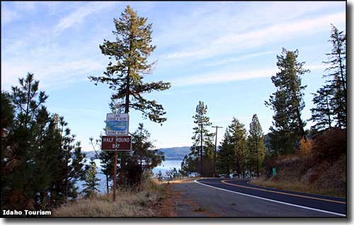 Near Half Round Bay on the Couer d'Alene Scenic Byway 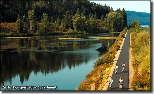 Trail of the Couer d'Alenes 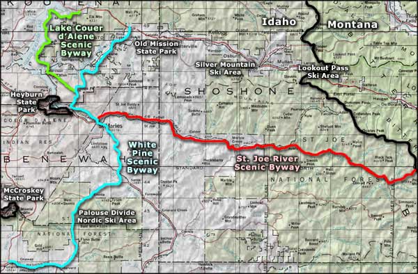 Lake Couer d'Alene Scenic Byway area map |
|
|
 |
| Index - Arizona - Colorado - Idaho - Montana - Nevada - New Mexico - Utah - Wyoming National Forests - National Parks - Scenic Byways - Ski & Snowboard Areas - BLM Sites Wilderness Areas - National Wildlife Refuges - National Trails - Rural Life Advertise With Us - About This Site - Privacy Policy |
| Photos courtesy of the Idaho Tourism & Idaho Transportation Department. Area map courtesy of National Geographic Topo! Text Copyright © by Sangres.com. All rights reserved. |