 |
Lookout Pass Ski Area |
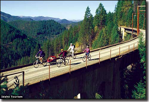 Riding the Hiawatha Trail near Lookout Pass |
|
Lookout Pass Ski Area is on the crest of the Bitterroot Range, the border between Idaho and Montana. Lookout Pass Ski Area is immediately adjacent to Interstate 90. It snows early and often here, a fine, light powder that is magical to ski in. Lookout Pass has operated a free Ski School for Children for more than 60 years. The B-52 Terrain Park offers banks, huge launches and a 1,111-foot-long natural quarter-pipe. In the summer, Lookout Pass also sees significant traffic as it's one of the prime staging areas for folks biking the Hiawatha Trail: a route that follows the abandoned railroad trackbed from St. Regis, Montana to Pearson, Idaho. |
| Quick Facts about Lookout Pass Ski Area |
|
Nearest City: Mullan
GPS Coordinates: 47.455, -115.708333 Google Satellite Map Season: Late November to early April (Weather permitting) Hours of operation: 9:30 AM to 4:00 PM, Wednesdays through Mondays Lifts: 4 * 3 double chairs * 1 rope tow Base Elevation: 4,500 ft
Top Elevation: 5,650 ft Vertical Rise: 1,150 ft Skiable Terrain: 540 Acres Average Annual Snowfall: 400 inches Snowmaking: No Night skiing: No Terrain Parks: 2 Number of Trails: 34 Trails Classifications: Beginner: 20% More Difficult: 50% Most Difficult: 20% Experts Only: 10% Longest Run: 1.5 miles |
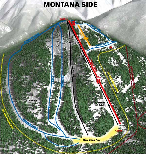 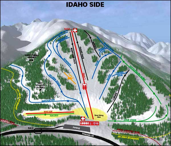 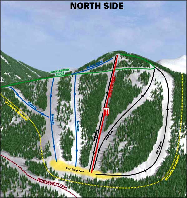 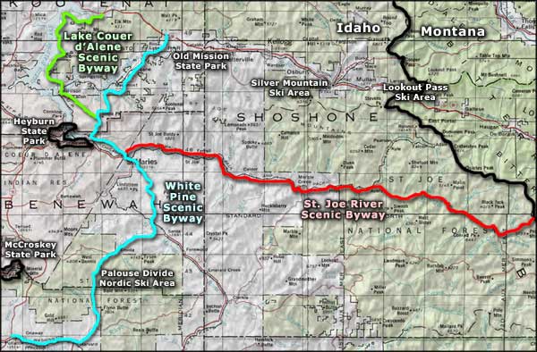 Lookout Pass Ski Area area map |
|
|
 |
| Index - Arizona - Colorado - Idaho - Montana - Nevada - New Mexico - Utah - Wyoming National Forests - National Parks - Scenic Byways - Ski & Snowboard Areas - BLM Sites Wilderness Areas - National Wildlife Refuges - National Trails - Rural Life Advertise With Us - About This Site - Privacy Policy |
|
Upper photo courtesy of the Idaho Department of Tourism. Ski Trails Maps courtesy of Lookout Pass Ski Area Map courtesy of National Geographic Topo! Text Copyright © by Sangres.com. All rights reserved. |