 |
Thousand Springs Scenic Byway |
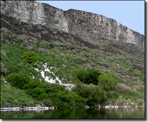 A spring coming out of the rock just above the Snake River |
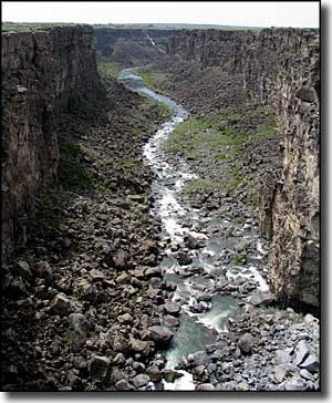
In the area of the Thousand Springs Scenic Byway, the Snake River has cut a deep gorge through the volcanic rock to the point where water flowing in the Snake River Plains Aquifer is able to emerge from the sides of the canyon and cascade into the river below. The Thousand Springs Scenic Byway travels through the area mostly on US Highway 30 from the town of Bliss on Interstate 84 west of Twin Falls to US Highway 93 in Twin Falls, where the route turns north and returns to the Interstate. Or, you can continue east through Twin Falls on Idaho Highway 50 and return to the Interstate a few more miles further to the east. That water in the Snake River Plains Aquifer has been traveling underground through an area of several thousand square miles, so when it does emerge and fall into the river, it's pure, oxygenated water at a steady year-round 58°F temperature, perfect for the growing of trout. And in the 30-mile stretch of the Snake River in the Hagerman Valley, probably 70% of the trout commercially raised in the US is produced. There are also a couple state and Federal fish hatcheries in the area. Some of the water here has been diverted by irrigation and hydroelectric projects so there's no longer a "thousand springs" showing, but there sure is a lot of water coming out of the ground here. If you're up to it, there are operators in Twin Falls and Hagerman that offer guided tours on the river and of Shoshone Falls, a waterfall 52' higher than Niagara Falls. This area of the river saw significant "tourism" during the days of the Oregon Trail. There have been changes since then, mostly because of the irrigation diversions and hydroelectric projects. And the incredible fossil beds that make up the paleontological resources of Hagerman Fossil Beds National Monument hadn't been discovered in those days. No one realized how extensive that collection of ancient remains was until the first excavations began in 1929. Perrine Memorial Bridge spans the Snake River Canyon near Twin Falls. The road surface of the bridge is normally 486 feet above the surface of the river, making this the highest bridge in Idaho. There are pullouts along the road near the bridge that give access to hiking trails along the rim of the canyon, affording great views of both the canyon and the bridge. |
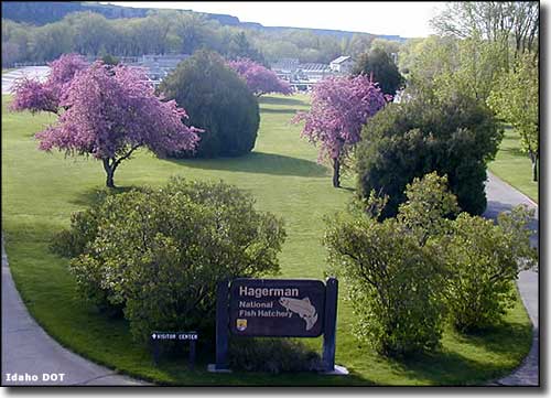 Hagerman National Fish Hatchery 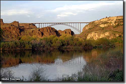 Perrine Memorial Bridge from the canyon floor 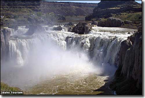 Shoshone Falls 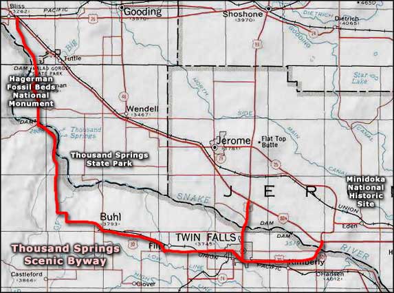 Thousand Springs Scenic Byway area map |
|
|
 |
| Index - Arizona - Colorado - Idaho - Montana - Nevada - New Mexico - Utah - Wyoming National Forests - National Parks - Scenic Byways - Ski & Snowboard Areas - BLM Sites Wilderness Areas - National Wildlife Refuges - National Trails - Rural Life Advertise With Us - About This Site - Privacy Policy |
| Some photos courtesy of Byways.org. Other photos courtesy of Idaho Tourism. Area map courtesy of National Geographic Topo! Text Copyright © by Sangres.com. All rights reserved. |