 |
Thousand Springs State Park |
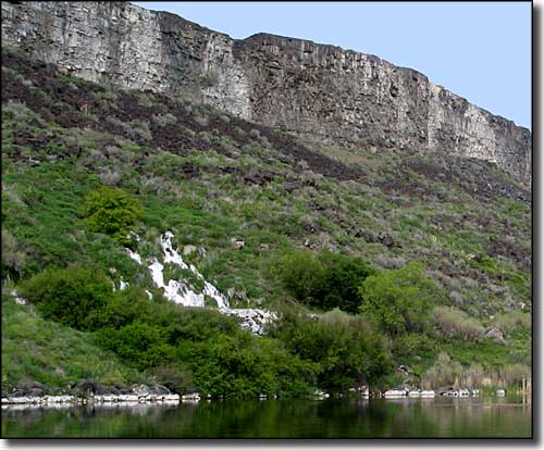
 Springs in the valley of the Snake River |
|
Thousands Springs State Park is a complex/combination of 5 separate units along the I-84 corridor in the Magic Valley of Idaho. Included is Malad Gorge, Billingsley Creek, Ritter Island, Earl M. Hardy Box Canyon Springs Nature Preserve, Niagara Springs and Crystal Springs. The Malad Gorge Unit is a 652-acre park a mile off the Tuttle exit on the I-84. In the park, the Malad River works its way down a stairstep waterfall, then drops into the Devil's Washbowl before entering a 250-foot deep gorge cut into the rock as it flows that last 2.5 miles downstream to meet with the Snake River. The views from the bridge across the canyon are spectacular but the only route to the bottom of the canyon requires that you go to the Idaho Power service road off of State Highway 30. The Kelton Trail, a sub-route of the Oregon Trail cuts across the park, leaving wagon ruts in some areas and the remains of the Kelton Stage Stop. Hiking, picnicking and day-use are allowed but there is no camping within the park. Billingsley Creek is a day-use unit in the Hagerman Valley that used to be the Emerald Valley Ranch. The property offers an indoor horse-riding arena, featured events throughout the year, some excellent fishing opportunities and spectacular wildlife viewing. The park also runs a local Farmer's Market and a summer "Blues in the Park" program. The Ritter Island Unit is nestled between two great springs along the Snake River. This is a very picturesque area with lots of birdwatching opportunities. Ritter Island is the site of the annual Thousand Springs Art Festival. As this is the newest unit in the Thousand Springs Complex, development of Ritter Island is not finished yet. The historic structures on the property are still being worked over and the homes may soon be available as overnight accommodations. The Earl M. Hardy Box Canyon Springs Nature Preserve surrounds a natural spring in a box canyon that flows some 180,000 gallons of water per minute. There is a hiking trail that offers great views of the springs and leads to an overlook next to a 20' waterfall. Niagara Springs is a National Natural Landmark where the icy blue waterfalls drop down the canyon wall at 250 cubic feet per second. This is an area where you can actually drive down the 350' wall into the Snake River Canyon (as long as you are not driving a motorhome or pulling a trailer). At the bottom, you'll be able to check out the fishing at Crystal Springs Lake (there is even a handicapped accessible fishing area). There are also modern restrooms, a group picnic shelter and individual picnic tables. |
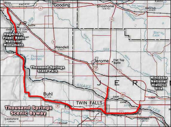
 Thousand Springs State Park area map |
|
|
 |
| Index - Arizona - Colorado - Idaho - Montana - Nevada - New Mexico - Utah - Wyoming National Forests - National Parks - Scenic Byways - Ski & Snowboard Areas - BLM Sites Wilderness Areas - National Wildlife Refuges - National Trails - Rural Life Advertise With Us - About This Site - Privacy Policy |
| Photo courtesy of Byways.org Map courtesy of National Geographic Topo! Text Copyright © by Sangres.com. All rights reserved. |