 |
Beaverhead County, Montana |
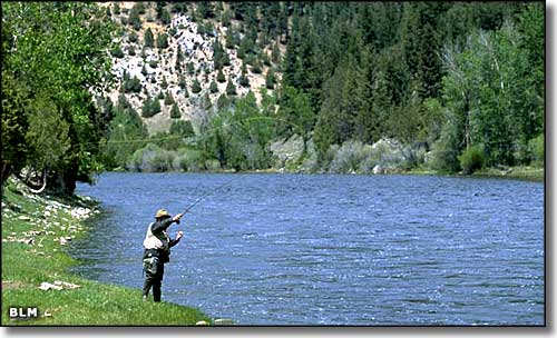 Fishing on the Big Hole River in Beaverhead County |
|
Beaverhead County is in southwestern Montana with Idaho to the south and west (the boundary is actually the Continental Divide). Interstate 15 bisects the county north and south. The Red Rock Lakes National Wildlife Refuge is here, as is a Lewis and Clark Memorial and the Sacajawea Historic Area near Lemhi Pass. Beaverhead County was founded in 1864 and contains 5,542 square miles of land and 30 square miles of water. The county seat is Dillon. |
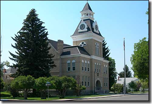 Beaverhead County Courthouse in Dillon |
| Fast Facts about Beaverhead County, Montana |
|
Resident Racial Breakdown:
White Non-Hispanic: 92.5% Hispanic: 3.5% Native American: 1.0% Asian: 1.4% Two or More Races: 1.2% Types of Jobs: Private Sector, wages or salary: 63% Government Sector: 25% Unincorporated, Self-Employed: 11% Homemaker, Unpaid: 1% Population Density: 2 People per Square Mile 2011 Cost of Living Index for Beaverhead County: 86.5
2009 Estimates: Population: 8,976 Males: 4,596 Females: 4,380 Median Resident Age: 37.6 Years Estimated Median Household Income: $37,100 Estimated Median Home Value: $162,300 Major Industries: Agriculture & Forestry, Educational Services, Lodging & Food Services, Health Care, Construction, Government, Finance & Insurance Services, Mining, Professional Services |
|
|
 |
| Index - Arizona - Colorado - Idaho - Montana - Nevada - New Mexico - Utah - Wyoming National Forests - National Parks - Scenic Byways - Ski & Snowboard Areas - BLM Sites Wilderness Areas - National Wildlife Refuges - National Trails - Rural Life Advertise With Us - About This Site - Privacy Policy |
| Top photo of the Big Hole River Recreation Sites is courtesy of the Bureau of Land Management Text Copyright © by Sangres.com. All rights reserved. |