 |
Wisdom, Montana |
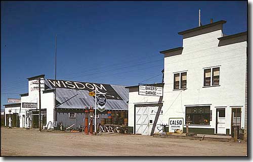 Downtown Wisdom, Montana in 1942 |
|
Wisdom is a Census Designated Place in the Big Hole Valley with the Beaverhead Mountains to the west and the Pioneer Mountains to the east. In the listings of "the coldest places in America," Wisdom figures prominently. However, when the weather is good, this area is gorgeous. Lewis & Clark traveled through this area on their journey west in 1805. Lewis named the river "Wisdom" (for one of Thomas Jefferson's most admired traits) but that name was officially changed to "Big Hole" in 1890. William Clark and his men came back through here in 1806. They camped overnight in the area of today's town of Wisdom, then headed south to go around the Pioneer Mountains. 18 miles to the south they discovered the Jackson Hot Springs where they tested the temperature of the water by boiling a dinner of wild game in it as the water flowed out of the ground. Over the years this valley saw many fur trappers. Then gold was discovered in the Ruby Creek area in the spring of 1862. Then came the large gold strike at Bannack later that year. 1882 is when the first serious homesteaders arrived in the Wisdom area. Apparently, the first thing they did was build huge mounds of firewood to make sure they got through the winter. At first the community was called "The Crossings" but it was established and surveyed as "Wisdom" in 1892. The first, last and only cash crop in this area is hay: with a 5-month growing season that's the only commodity that continues to produce. Wisdom thrived in the early part of the 1900's as the population grew to several thousand and the local economy was fueled by cattle and grass hay. Today, Wisdom still has a post office but is no longer an incorporated town. Compared to the early 1900's, it's almost a ghost town. Cattle and grass hay are still the big money-makers but Wisdom is also home to a small but growing artist community. The Big Hole Battlefield of Nez Perce National Historic Park is about 13 miles west of Wisdom via Montana Highway 43. |
| Fast Facts about Wisdom, Montana |
|
Wisdom, Beaverhead County, MT 59761
Founded: 1882 Elevation: 6,050' Latitude: 45.6161°N Longitude: 113.4497°W Resident Racial Breakdown: White Non-Hispanic: 96.5% Hispanic: 1.8% Native American: 1.8% Other: 1.8% Education: High School or Higher: 92.9% Bachelor's Degree or Higher: 16.3% Graduate or Professional Degree: 5.1%
2009 Estimates:
Population: 109 Males: 55 Females: 54 Median Resident Age: 49.0 Years Estimated Median Household Income: $22,100 Estimated Median Home Value: $115,600 Population Density: 115 People per Square Mile 2011 Cost of Living Index for Wisdom: 87.5 Major Industries: Lodging & Food Services, Construction, Agriculture, Broadcasting & Telecommunications, Waste Management Services, Government, Social Services, Educational Services Unemployed (March 2011): 6.6% |
|
|
Beaverhead County Related PagesOther Beaverhead County Related Pages
Maverick Mountain Ski Area - Beaverhead-Deerlodge National Forest
Nez Perce National Historic Park - Centennial Mountains - BLM - Bannack State Park Big Sheep Creek Back Country Byway - Big Hole River Recreation Sites - BLM Montana Pages |
 |
| Index - Arizona - Colorado - Idaho - Montana - Nevada - New Mexico - Utah - Wyoming National Forests - National Parks - Scenic Byways - Ski & Snowboard Areas - BLM Sites Wilderness Areas - National Wildlife Refuges - National Trails - Rural Life Advertise With Us - About This Site - Privacy Policy |
| Photo of Wisdom, Montana in 1942 courtesy of John Vachon, LOC Text Copyright © by Sangres.com. All rights reserved. |