 |
Belt, Montana |
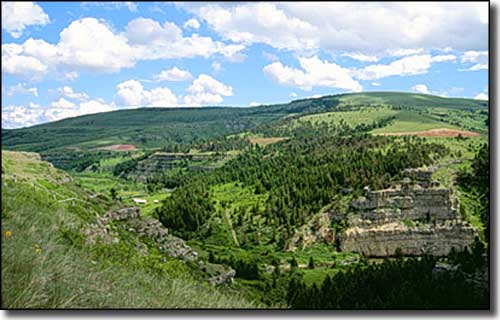 The countryside around Belt |
Near the town of Belt is a mountain that looks like it has a belt of rocks around it: that's where the name came from. The town straddles Belt Creek, a small river that flows north out of the Little Belt Mountains and passes by Sluice Boxes State Park before it gets to Belt. The area around Sluice Boxes saw considerable mining back in the day and there used to be a railroad connecting that area with Belt and Great Falls. A lot of the old buildings and mining equipment is still there, accessible via the abandoned railroad grade. Don't expect any amenities though: Montana opened the state park in 1974 as a "primitive site" and that classification isn't going to change. Belt was originally founded by John Castner, who founded the first coal mine in Montana just outside of town. Castner named that first settlement after himself and sold his coal to the Army post at Fort Benton. Then the Boston and Montana Mining Company arrived in 1893 and set up their own operations in the Belt coal fields. They imported workers, built housing, renamed the town and supplied coal to the smelter at nearby Great Falls. Most of the miners in those days were Slavic and Finnish immigrants who worked long, hard hours until 1930 when the smelters were converted to use natural gas instead of coal. Belt does still retain the Castner name: Castner Street is the main drag. 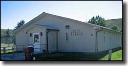
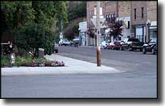
Belt is east of the city of Great Falls, near the northern end of the Kings Hill Scenic Byway. If you happen to be in town (or just passing through), check out the Belt Museum. The museum is housed in the former city jail (built in 1895) and offers exhibits of photos, historical records and the work of local artists in addition to giving you a chance to sit in one of the original jail cells and visit a local coal mine. A good part of downtown Belt is listed on the National Register of Historic Places. These days, there isn't much mining going on but cattle ranching is very much alive and well in this part of Montana. |
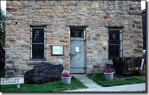 Belt Museum, in the old Belt Town Jail |
| Fast Facts about Belt, Montana |
|
Belt, Cascade County, MT 59412
Elevation: 3,510' Latitude: 47.3859°N Longitude: 110.9266°W Resident Racial Breakdown: White Non-Hispanic: 97.5% Hispanic: 0.4% Native American: 0.9% Two or more races: 1.2% Education: High School or Higher: 83.8% Bachelor's Degree or Higher: 13.0% Graduate or Professional Degree: 1.8%
2009 Estimates: Population: 589 Males: 280 Females: 309 Median Resident Age: 39.0 Years Estimated Median Household Income: $42,700 Estimated Median Home Value: $110,750 Population Density: 1,747 People per Square Mile 2011 Cost of Living Index for Belt: 87.1 Major Industries: Government, Health Care, Educational Services, Lodging & Food Services, Agriculture, Finance & Insurance Services, Social Services, Professional Services, Machinery & Equipment Wholesalers Unemployed (March 2011): 6.9% |
|
|
 |
| Index - Arizona - Colorado - Idaho - Montana - Nevada - New Mexico - Utah - Wyoming National Forests - National Parks - Scenic Byways - Ski & Snowboard Areas - BLM Sites Wilderness Areas - National Wildlife Refuges - National Trails - Rural Life Advertise With Us - About This Site - Privacy Policy |
| Larger photos courtesy of the Montana Office of Tourism. Text Copyright © by Sangres.com. All rights reserved. |