 |
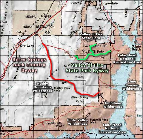
Valley of Fire Scenic Byway |
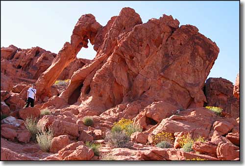 Elephant Rock in Valley of Fire State Park |
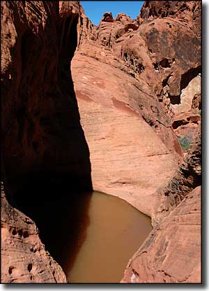
The Valley of Fire Scenic Byway works its way through the Valley of Fire State Park: a large and unique collection of wind-sculpted red sandstone northeast of Las Vegas off Interstate 15. The rock colors actually vary from whites and tans to deep reds and purples. As spectacular as the colors are during the day, the land really comes alive in the highly slanted rays of the sun that accompany each day's sunrise and sunset. That's when this valley lives up to its name: Valley of Fire. During the day, though, if you watch, you can see the colors shift as the sun makes its journey across the sky and its rays change their angle of incidence against the grains of silica that make up in the rock. The sandstone was first laid down as sand dunes several hundred feet deep about 150 million years ago. At that time, the whole of the southwest was buried under the same windswept dunes. Later on, this area was plunged under the ocean and the sand dunes compressed to make the rock we see today. Since that time, areas of that compressed sandstone have become exposed to the elements again and it's the result of eons of wind and water erosion that have created the fantastical shapes and formations that adorn this countryside. So driving along this scenic byway is to take a drive through sands of time that were in place here long before the advent of the dinosaurs... Every turn in the road brings something truly ancient and yet brand new into view... |
 |
|
|

|
| Index - Arizona - Colorado - Idaho - Montana - Nevada - New Mexico - Utah - Wyoming National Forests - National Parks - Scenic Byways - Ski & Snowboard Areas - BLM Sites Wilderness Areas - National Wildlife Refuges - National Trails - Rural Life Advertise With Us - About This Site - Privacy Policy |
| Photo of Elephant Rock in Valley of Fire State Park courtesy of Wikipedia userid Lilybay, CCA ShareAlike 3.0 License. Upper left photo courtesy of Sandrine Berger © 2005, via Byways.org, Area map courtesy of National Geographic Topo! Text Copyright © by Sangres.com. All rights reserved. |