 |
Lake Mead National Recreation Area |
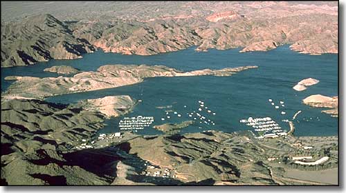 The Las Vegas Marina |
|
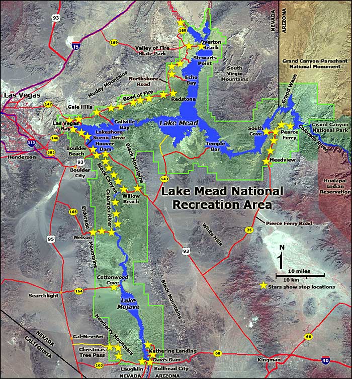
Lake Mead National Recreation Area contains most of Lake Mead and Lake Mohave in it's 1,500,000 acres. These are huge lakes in the desert that cater to water sports enthusiasts, desert lovers and folks who just want to hang out in warm places during cold winters. Lake Mead was created by the construction of Hoover Dam, Lake Mohave by the construction of Davis Dam. These 2 dams have tamed hundreds of miles of the Colorado River and provided water, recreation and electric power to millions of people in the process. Lake Mead was named for the commissioner of the US Bureau of Reclamation from 1924 to 1936 (the planning and construction years of Hoover Dam): Elwood Mead. |
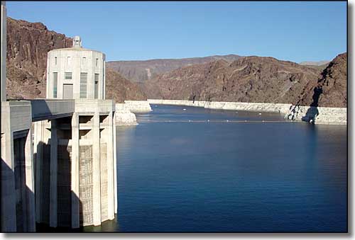 Looking north from Hoover Dam (the "bathtub ring" shows the high water mark of the lake) |
|
The water level in Lake Mead fluctuates with the seasons. Incoming water varies depending on snow and rainfall upstream on the Colorado River. Outgoing water amounts don't change much from year to year. If more water flows out than flows in over a several year period, the lake sees major changes in overall water levels. Between May, 2000 and May 2003, the water level in Lake Mead dropped some 60 feet. What this means is that some of the marinas and boat ramps had to be relocated to keep them in the water. Lake Mead dropped like this in 1955 but returned to full levels the next year. It dropped again in the mid-1960's but that time, it took a decade before water levels returned to near normal. Lake Mead is where three desert eco-systems come together: the Sonoran Desert, the Great Basin desert and the Mohave desert. This makes for a wild mix of plants and animals, some of which occur nowhere else on Earth. Jagged mountain ranges rim the lake, so rugged and barren that a lot of the countryside is now designated wilderness. Lake Mead Recreation Area is open 24 hours a day, every day of the year. Some beaches and other well-signed areas are for day-use only. The Alan Bible Visitor Center on Lakeshore Scenic Dive is open from 8:30 am to 4:30 pm every day of the year except Thanksgiving, Christmas and New Year's Day. Entrance fees: $5 per vehicle, good for up to five days from date of purchase; $3 per pedestrian, bicyclist or motorcyclist, good for up to five days from date of purchase. There are also fees for putting a motorized boat on the lake. $10 for the first boat, $5 for each additoinal boat, good for up to five days from date of purchase. Canoes, kayaks and rafts are free. |
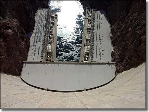 Looking down the south side of Hoover Dam 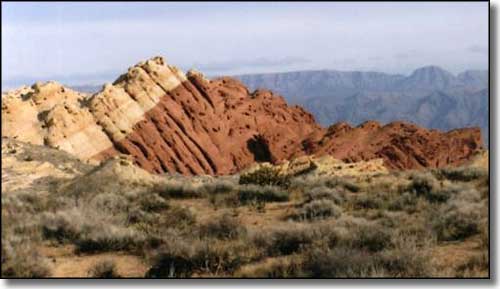 Red rock formation near Redstone Picnic Area 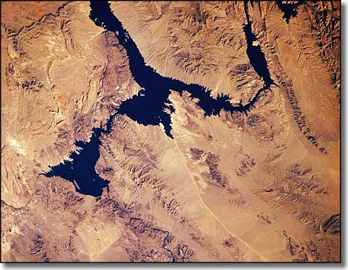 Lake Mead from space (north is to the upper left) |
 |
|
|
Lake Mead National Recreation Area Pages
South of Hoover Dam - Permitted Concessioners - Lake Mead
Spirit Mountain Wilderness - Jimbilnan Wilderness - Pinto Valley Wilderness Black Canyon Wilderness - Bridge Canyon Wilderness - El Dorado Wilderness Ireteba Peaks Wilderness - Nellis Wash Wilderness Lake Mead National Recreation Area Related Pages
Valley of Fire State Park - Valley of Fire Scenic Byway
Gold Butte Back Country Byway - Bitter Springs Back Country Byway Muddy Mountains Wilderness - Lime Canyon Wilderness - Jumbo Springs Wilderness Nevada Pages |

|
| Index - Arizona - Colorado - Idaho - Montana - Nevada - New Mexico - Utah - Wyoming National Forests - National Parks - Scenic Byways - Ski & Snowboard Areas - BLM Sites Wilderness Areas - National Wildlife Refuges - National Trails - Rural Life Advertise With Us - About This Site - Privacy Policy |
| Most photos and map of Lake Mead National Recreation Area courtesy of the National Park Service and USGS. Photo of red rocks near Redstone Picnic Area courtesy of Nebular110, CCA ShareAlike 3.0 License Image of Lake Mead from space courtesy of NASA Text Copyright © by Sangres.com. All rights reserved. |