 |
Lahontan State Recreation Area |
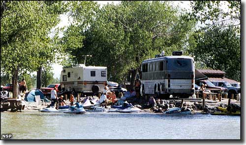 A typical holiday weekend at Lahontan State Recreation Area |
|
18 miles west of Fallon and 45 miles east of Carson City, Lahontan State Recreation Area surrounds a reservoir almost 17 miles long with 69 miles of shoreline. When full, the lake offers almost 10,000 acres of water surface. Lahontan Dam (162 feet high and 1,700 feet long at the top) was completed in 1915. The project diverts and stores water from the Carson and Truckee River basins to produce hydroelectric power and for use in irrigated fields near Fallon. That irrigation project then drains into the Stillwater Wildlife Management Area, a huge waterfowl refuge in west-central Nevada. The reservoir and dam are named for the ancient Lake Lahontan, an 8,500-square-mile lake that covered this part of the Great Basin during the last Ice Age. The sandy shores of that ancient lake can still be seen high on the sides of the surrounding mountains. Lahontan State Recreation Area is open year-round but sees maximum use from late spring through summer. There is developed camping at Silver Springs Beach #7 with modern restrooms, cooking grills and picnic tables (but this campground is closed in the winter and early spring because of freezing temperatures). Primitive camping is allowed on the beach everywhere except in the day use and boat ramp areas. ATV use is not allowed anywhere in the park. Entry fees: $7 per vehicle per day for non-Nevada residents, $5 per vehicle per day for Nevada residents. Camping: $15 per site per night for non-Nevada residents, $13 per site per night for Nevada residents. Boat launch fees: $14 per boat per day for non-Nevada residents, $12 per boat per day for Nevada residents. Camp/Boat Combo: $22 per day/night combo for non-Nevada residents, $20 per day/night combo for Nevada residents. Group Picnic Shelters: $15 + normal vehicle entry fees. Group Campsites: $15 + normal campsite fees. |
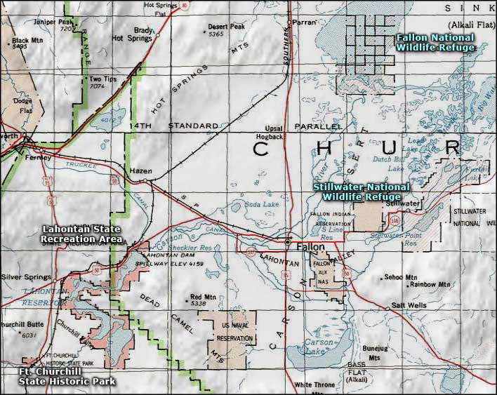 Lahontan State Recreation Area area map |
|
|

|
| Index - Arizona - Colorado - Idaho - Montana - Nevada - New Mexico - Utah - Wyoming National Forests - National Parks - Scenic Byways - Ski & Snowboard Areas - BLM Sites Wilderness Areas - National Wildlife Refuges - National Trails - Rural Life Advertise With Us - About This Site - Privacy Policy |
| Area map courtesy of National Geographic Topo! Text Copyright © by Sangres.com. All rights reserved. |