 |
Fallon National Wildlife Refuge |
|
|
|
Fallon National Wildlife Refuge was established in 1931 in the area of the Carson Sink: that place where the waters of the Carson River sink into the sand and gravel of the Great Basin. However, that was back in the days when most water flowing in the Carson River actually made it this far downstream. These days, so much of the Carson is diverted to feed people and agriculture around Carson City and Reno/Sparks that unless it's a very heavy snowfall year, very little water makes it to the Refuge. But in good water years, Fallon National Wildlife Refuge provides some 15,000 acres of wetland habitat and desert playa for migratory birds. This area is mostly an uplands dominated by greasewood/saltbush shrublands on a gently-rolling-to-flat desert floor. There's also a system of active and stable sand dunes in this area. Limited hunting, including upland game and waterfowl, is allowed in the Fallon National Wildlife Refuge. Access is limited to open roads and you'll want high clearance 4WD, although even that won't help you if it starts raining. Fallon National Wildlife Refuge is open 24 hours a day, every day. However, there are no amenities and the roads are less than primitive. Nor are any of the "roads" marked. High-clearance 4WD is highly recommended. If you want to visit, stop by the Stillwater National Wildlife Refuge office (1000 Auction Road in Fallon), get a map and talk to them. Fallon National Wildlife Refuge is administered by the U.S. Fish & Wildlife Service as part of the Stillwater National Wildlife Refuge Complex. |
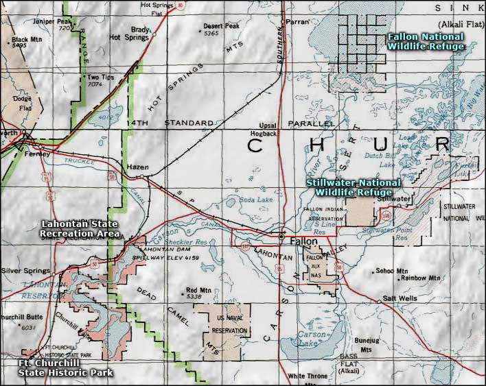 Fallon National Wildlife Refuge area map |
|
|

|
| Index - Arizona - Colorado - Idaho - Montana - Nevada - New Mexico - Utah - Wyoming National Forests - National Parks - Scenic Byways - Ski & Snowboard Areas - BLM Sites Wilderness Areas - National Wildlife Refuges - National Trails - Rural Life Advertise With Us - About This Site - Privacy Policy |
| Map courtesy of National Geographic Topo! Text Copyright © by Sangres.com. All rights reserved. |