 |
East Humboldt Wilderness |
|
|
 Angel Lake, at the northern end of the East Humboldt Wilderness |
|
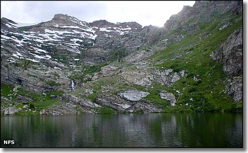
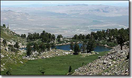
The East Humboldt Wilderness contains 36,670 acres in the East Humboldt Range, just southwest of Wells, Nevada. In the center of the East Humboldt Wilderness is Hole-in-the-Mountain Peak (11,306') while in the southern portion of the wilderness is 11,020' Humboldt Peak. This is a very remote and rugged area of cliffs, talus slopes and the U-shaped canyons and sharp peaks typical of a heavily glaciated area, with typical desert grasses and sage lower down and limber pine, mountain mahogany and aspen higher up. Access is very limited but if you do get in, you'll find bighorn sheep, mountain goats, deer, bobcats and mountain lions. There's also 6 fishing lakes with brook and cutthroat trout. At the far northern end of the East Humboldt Wilderness is Angel Lake, at the foot of a classic rock-and-alpine-scrub cirque. On a nearby ridge is a grey monolith that can be seen from Wells. The campground at Angel Lake (accessible by car) also serves as the trailhead for several trails that lead into and through the East Humboldt Wilderness. In hiking around you may come across prehistoric hunting blinds and much more recent mine structures and Basque tree carvings. The Hole-in-the-Mountain Natural Research Area, designated in 1998, is partially within the East Humboldt Wilderness. |
 Smith Lake in the East Humboldt Wilderness 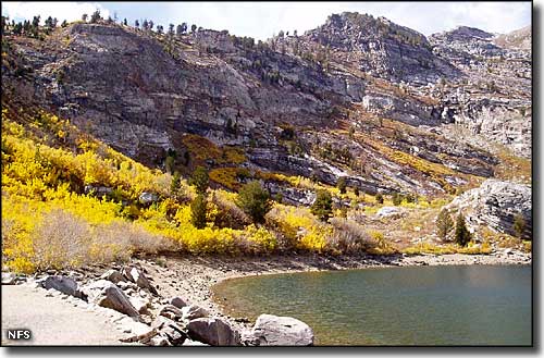 In the East Humboldt Wilderness 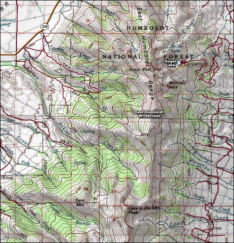 East Humboldt Wilderness map |
|
|

|
| Index - Arizona - Colorado - Idaho - Montana - Nevada - New Mexico - Utah - Wyoming National Forests - National Parks - Scenic Byways - Ski & Snowboard Areas - BLM Sites Wilderness Areas - National Wildlife Refuges - National Trails - Rural Life Advertise With Us - About This Site - Privacy Policy |
| Photo of Angel Lake courtesy of the National Forest Service. Photo of Smith Lake courtesy of G. Thomas. Lower photo of the East Humboldts Wilderness courtesy of Debbie Knudsen, National Forest Service Map of the East Humboldt Wilderness courtesy of National Geographic Topo! Text Copyright © by Sangres.com. All rights reserved. |