 |
Angel Lake Scenic Byway |
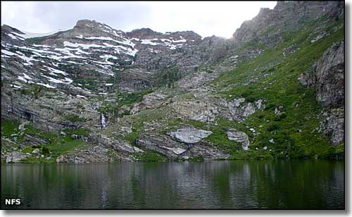 Angel Lake |
|
The Angel Lake Scenic Byway starts in Wells at the junction of Interstate 80 and US 93. From that point, the "Stairway to Heaven" follows State Route 231 southwest for 12 miles, rising several thousand feet through sagebrush, pinon pine and mountain mahogany into the aspen and limber pine zone in the East Humboldt Mountains before ending at Angel Lake in a high glacial cirque. Surrounded by northern Nevada's Great Basin desert, the East Humboldts are a conifer-and-aspen forested "island in the sky": as you rise into the mountains, you enter Humboldt-Toiyabe National Forest. Angel Lake is against the boundary of the East Humboldt Wilderness, an area of gorgeous mountainous countryside high in the East Humboldts. These mountains are high enough and north enough to have been heavily worked by the glaciers during the Ice Ages, leaving granite carved into scarps, cirques and spires in many places. Depending on snowfall and snow depth, the Angel Lake Scenic Byway tends to close around mid-October and open up again at the end of May. The last 4 miles of road are paved but very steep, twisted and poorly maintained: not recommended for large RV's or trailers. Angel Creek Campground (at the point where the road really begins to take a dump) is probably the best place to park big rigs, and it's not that far a hike from there to the lake itself, especially if you're able to follow the creek (which is a shorter path than the road is). Angel Creek Campground is open from June through September and charges $12 per site per night for each of the 18 available campsites (10 sites have tent pads). Sites offer picnic tables and fire rings and the campground has drinking water and 3 vault toilets. If you do drive to the end of the road you'll find the Angel Lake Recreation Area with 26 paved campsites (all except #10 have tent pads) plus barbecue grills, fire rings, picnic tables, drinking water and 4 vault toilets. The campground at Angel Lake Recreation Area is open from July through September and sites run $14 per site per night, $22 for doubles. You'll also find the trailhead at the rec area for a route that runs one mile into the wilderness to Smith Lake and another trail that runs six miles into the wilderness to Greys Lake. Angel Lake is a natural lake in the bowl of the cirque. Back in the early 1900's, folks built a dam at the outlet to raise the level of the lake and use that water for irrigation purposes in the valleys below. That's why Angel Lake itself is not part of the wilderness area. |
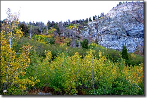 Near Angel Lake in the fall 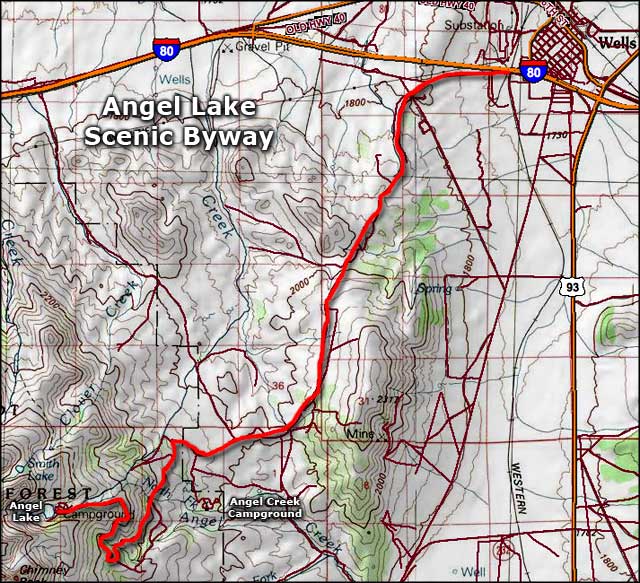 Angel Lake Scenic Byway area map |
|
|

|
| Index - Arizona - Colorado - Idaho - Montana - Nevada - New Mexico - Utah - Wyoming National Forests - National Parks - Scenic Byways - Ski & Snowboard Areas - BLM Sites Wilderness Areas - National Wildlife Refuges - National Trails - Rural Life Advertise With Us - About This Site - Privacy Policy |
| Photos of Angel Lake courtesy of the National Forest Service. Area map courtesy of National Geographic Topo! Text Copyright © by Sangres.com. All rights reserved. |