 |
Ruby Lake National Wildlife Refuge |
|
|
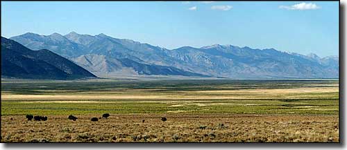 The view in Ruby Valley, Ruby Lake is the dark green area along the foot of the Ruby Mountains |
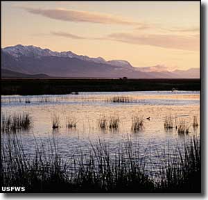
Established in 1938 by President Franklin Delano Roosevelt, the Ruby Lake National Wildlife Refuge lies in the Ruby Valley on the east side of the Ruby Mountains. This is 39,926 acres of preserved land in one parcel about 16 miles long and about 3 miles wide. Once upon a time, Ruby Lake was part of a much larger Ancient Lake Franklin. In those days, the lake covered some 470 square miles and was more than 200 feet deep. These days, the lake is much smaller and the maximum depth is about 5 feet. The elevation is right around 6,000'. The Ruby Mountains have more than 200 springs flowing from their lower reaches and feeding into Ruby Lake. The marsh covers about 17,000 acres with another 22,926 acres of grasslands, meadows, alkali playa and brush-covered uplands surrounding it. It's that combination of water, marshland and other resources that have made Ruby Lake National Wildlife Refuge such an important piece in the National Wildlife Refuge System. I say that and you have to realize: in the lower 48 states, it's hard to find another National Wildlife Refuge that is more remote. This location is shared by migratory birds flying both the Pacific and Central flyways. Ruby Lake is also a crossroads for birds flying east and west across the Great Basin area. The American Bird Conservancy has identified Ruby Lake National Wildlife Refuge as one of their 500 Globally Important Bird Areas. The South Marsh was designated a National Natural Landmark by the National Park Service because of the pristine condition and biological diversity of the habitat. South Marsh is important as it supports the largest number of canvasback duck nests west of the Mississippi River (and not in Alaska). While so much of the focus is on migratory birds and waterfowl, Ruby Lake also has a good population of sage grouse, pronghorn antelope and mule deer. Driving routes vary from 65 to 90 miles in length, with 17 to 35 mile stretches of gravel road (some of which is not regularly maintained). If you want to come here, bring everything you need, including extra fuel: fuel and basic groceries are sometimes available in Ruby Valley, but not always. Some routes are not open in winter. To get there: summer visitors usually drive 65 miles south from Elko on State Highway 228 south of Spring Creek and Jiggs to County Road 718. CR 718 goes up and over the Ruby Mountains through Harrison Pass. That means about 17 miles of CR 718 is a rough, steep, winding gravel road not recommended for anything more than maybe fifteen feet long. CR 718 is also closed if there's any amount of snow on the ground. A year round route involves driving south from Wells on US Highway 93 to State Road 229 to the hairpin turn where County Road 767 heads south through Ruby Valley to Ruby Lake. That's an 80 mile drive one way, about 35 miles on improved gravel. Another way in from Elko area is to get off Interstate 80 at exit 321 and follow State Road 229 south over Secret Pass to that same hairpin turn where County Road 767 goes south. That puts Ruby Lake about 90 miles from Elko. There are roads from the south, too, but we're talking 65-70 miles of dirt and gravel... |
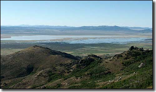 Franklin Lake, just north of Ruby Lake  Ruby Lake National Wildlife Refuge area map |
|
|

|
| Index - Arizona - Colorado - Idaho - Montana - Nevada - New Mexico - Utah - Wyoming National Forests - National Parks - Scenic Byways - Ski & Snowboard Areas - BLM Sites Wilderness Areas - National Wildlife Refuges - National Trails - Rural Life Advertise With Us - About This Site - Privacy Policy |
| Upper photo of the Ruby Valley is courtesy of Wikipedia userid Urban. Lower photo courtesy of G. Thomas. Other photos courtesy of Stephen Ingram, US Fish & Wildlife Service Map courtesy of National Geographic Topo! Text Copyright © by Sangres.com. All rights reserved. |