 |
Bruneau-Jarbridge Rivers Wilderness |
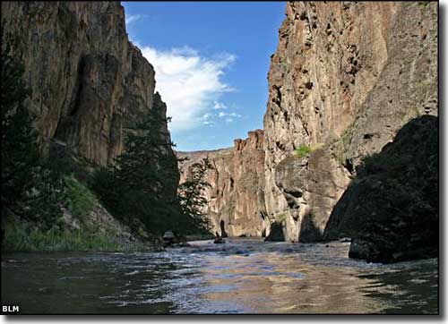 The Bruneau River in the Bruneau-Jarbridge Rivers Wilderness |
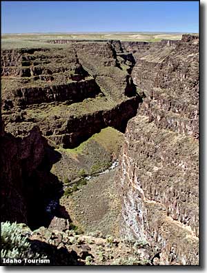
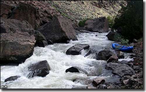
The Bruneau-Jarbridge Rivers Wilderness is comprised of about 89,996 acres of deep canyons and geological wonderland along the drainages of the Jarbridge and Bruneau River systems. Both rivers are designated Wild and Scenic Rivers for aboput 90 miles. The Jarbridge River offers whitewater enthusiasts a challenging 29-mile float through red volcanic cliffs with hoo-doos in a maze of spectacular winding canyons. Some of the river offers what is arguably the best Class V whitewater in Idaho. Eventually, the Jarbridge merges with the West Fork of the Bruneau River and that begins the 50-mile long Bruneau River. The Bruneau-Jarbridge Rivers Wilderness is composed mostly of the deep canyons cut into the volcanic materials of the plateau by the erosive force of the rivers. There are redband trout in the water with a few beaver and river otter living along the surface and bighorn sheep and a bobcat or two inhabiting the walls of the canyons. Other than that, it's a pretty barren area. Most canyon slopes are covered with bunchgrasses and big sagebrush species. The canyon bottoms contain dense rushes, sedges, grasses, poison ivy and stands of Western juniper. 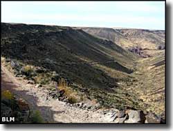
In most places, the wilderness boundary is marked by the canyon rim but in some areas, it extends into the surrounding plateau country. There is a small road that bisects the wilderness area into two units. It crosses the canyon just north of the Bruneau-Jarbridge confluence at Indian Hot Springs. Indian Hot Springs is the take-out point for folks rafting the Jarbridge Rivers, and the put-in point for folks embarking on the Bruneau River. Accessing that road requires 4WD with high clearance... the last couple miles are extremely rugged. Once you get there, though, there is a good campsite and the fishing is supposed to be good, too. The hot springs is located on the west bank of the river, upstream of the bridge (which is unsafe for vehicles but usable on foot). The water tends to be around 160°F but tends to cool off and be tolerable at the river's edge. In some areas you'll find unexcavated prehistoric cultural resources (foundations, rock art panels, etc.) The canyons vary from 200 to 1,200 feet deep and there are multiple vertical walls and thousands of rock spires. The Bruneau-Jarbridge Rivers Wilderness is within the Owyhee Desert, part of the Basin and Range physiographic province in southwestern Idaho. |
 Jarbridge River in the Bruneau-Jarbridge Rivers Wilderness 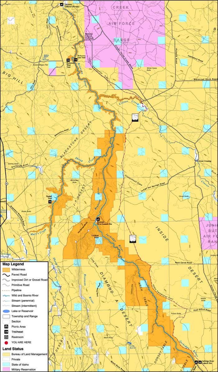 Bruneau-Jarbridge Rivers Wilderness 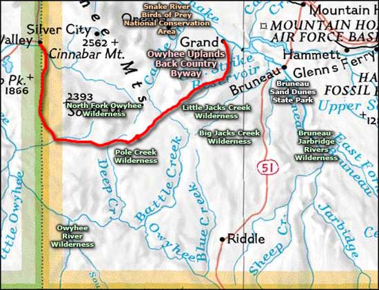 Bruneau-Jarbridge Rivers Wilderness location map |
|
|
Bruneau-Jarbridge Rivers Wilderness Related Pages
Big Jacks Creek Wilderness - Owyhee Uplands Back Country Byway
Little Jacks Creek Wilderness - Pole Creek Wilderness Owyhee River Wilderness - North Fork Owyhee Wilderness Birds of Prey National Conservation Area - Bruneau Dunes State Park Idaho Pages |
 |
| Index - Arizona - Colorado - Idaho - Montana - Nevada - New Mexico - Utah - Wyoming National Forests - National Parks - Scenic Byways - Ski & Snowboard Areas - BLM Sites Wilderness Areas - National Wildlife Refuges - National Trails - Rural Life Advertise With Us - About This Site - Privacy Policy |
| Upper right photo courtesy of the Idaho Department of Tourism. Other photos and big map courtesy of the Bureau of Land Management. Area map courtesy of National Geographic Topo! Text Copyright © by Sangres.com. All rights reserved. |